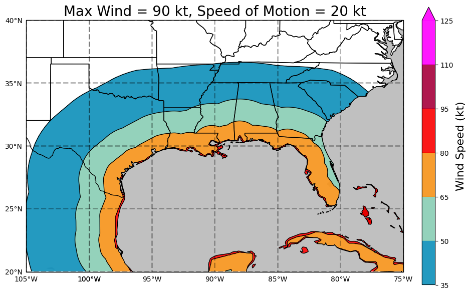
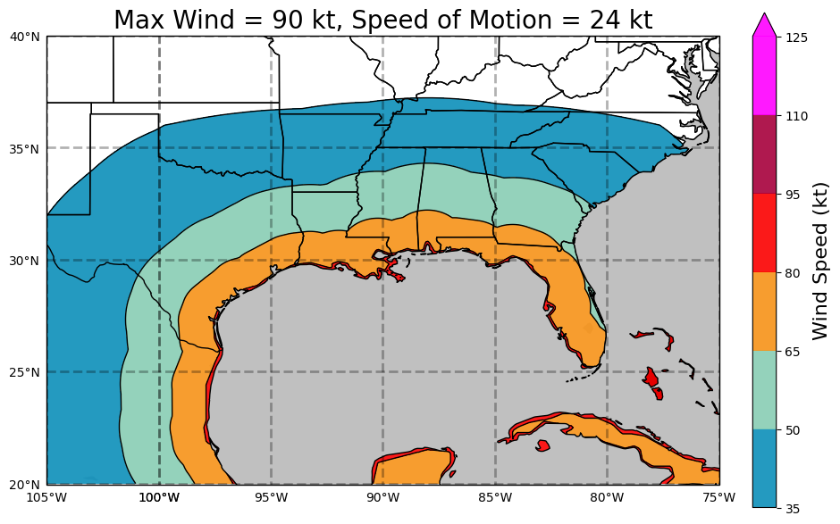
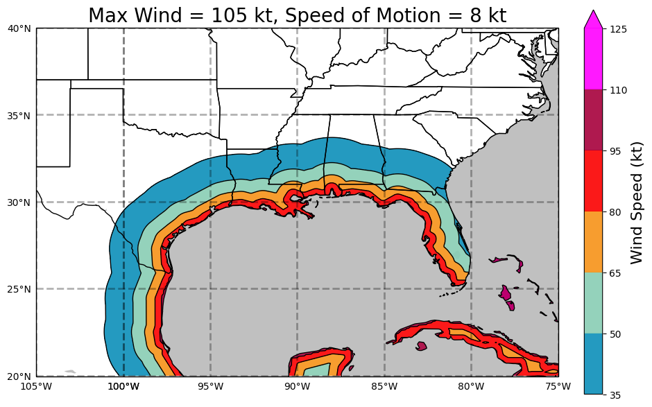
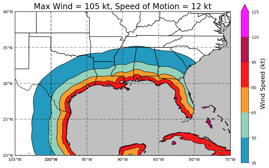
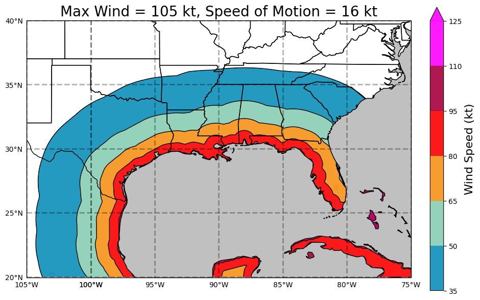
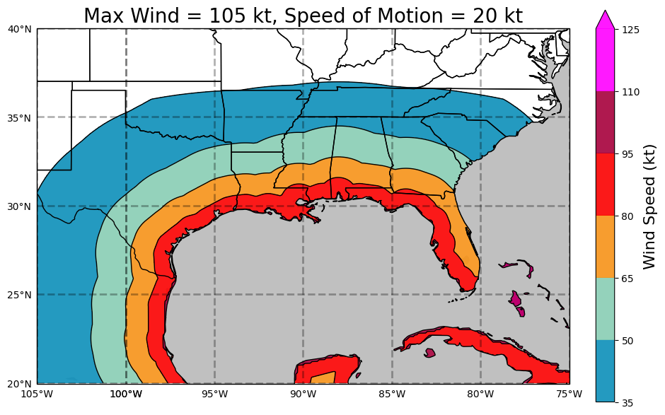
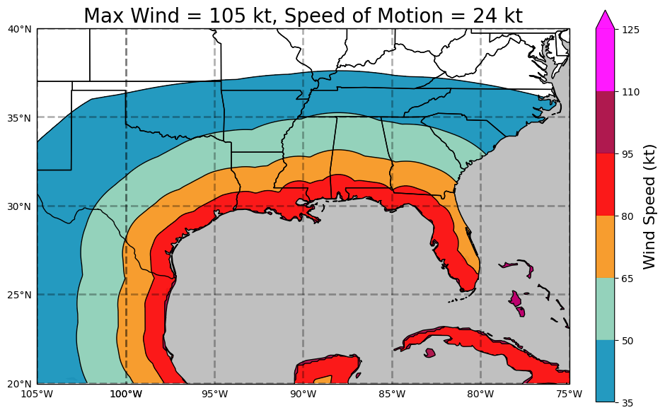
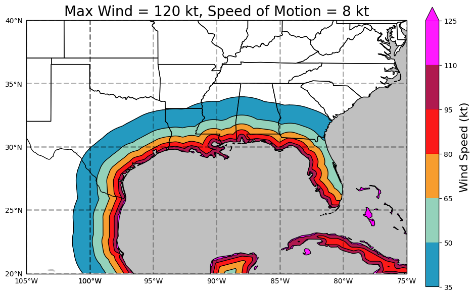
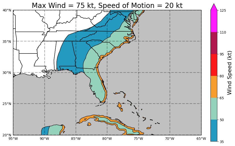
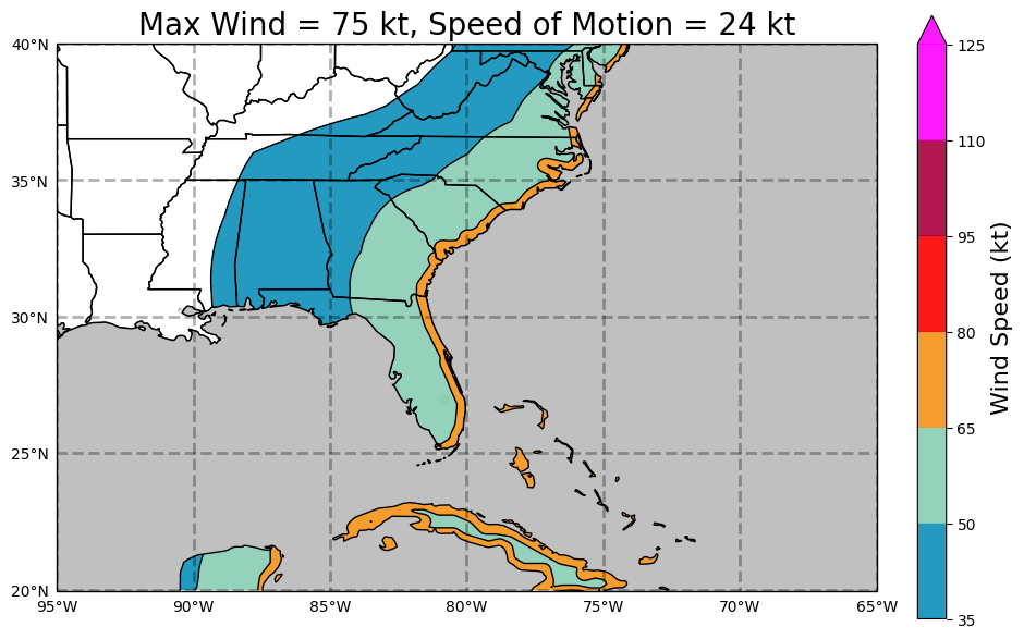
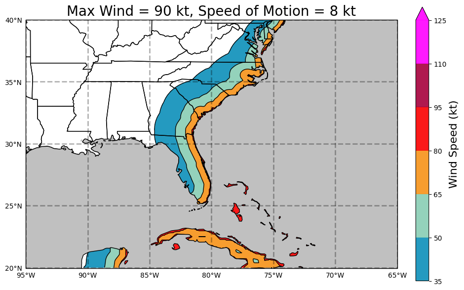
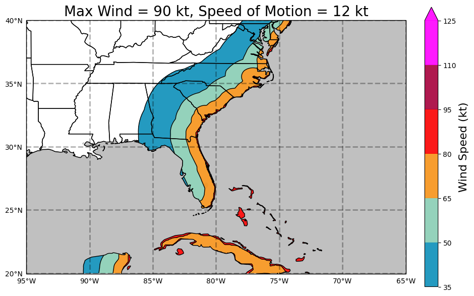
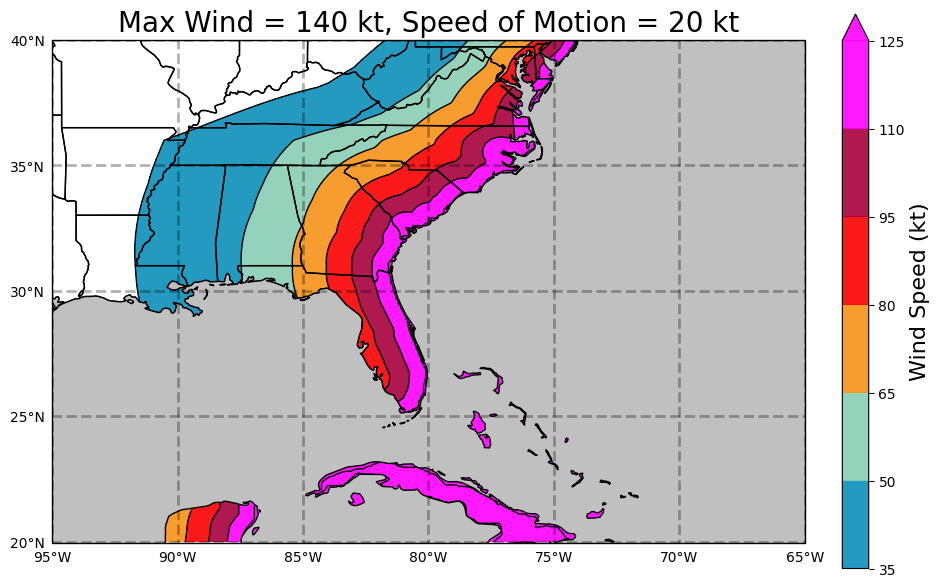
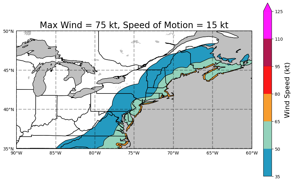
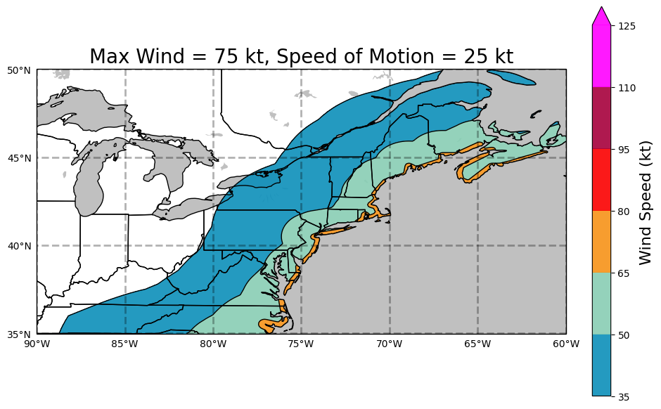
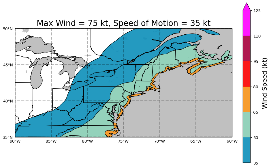
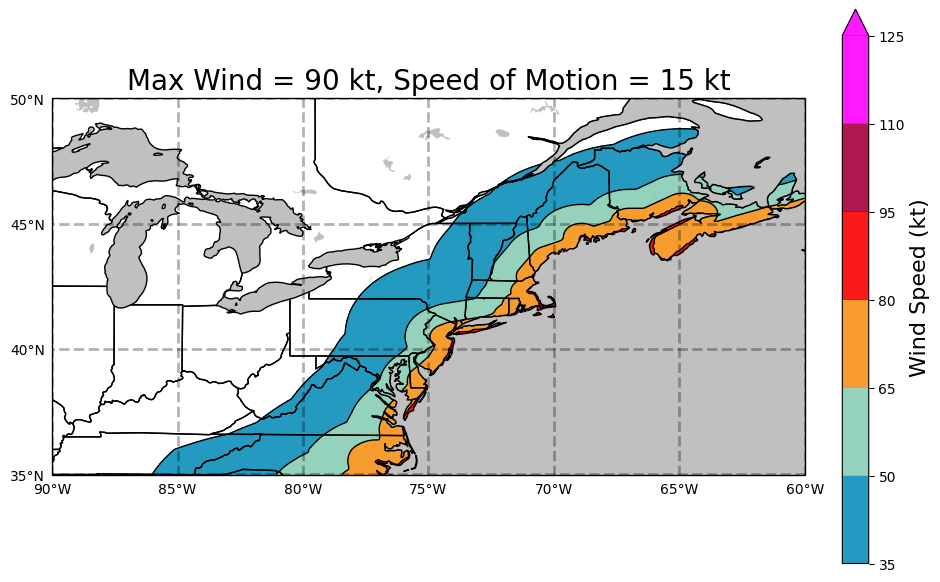
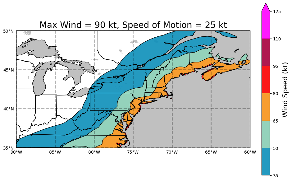
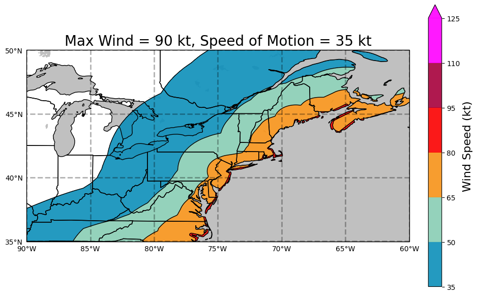
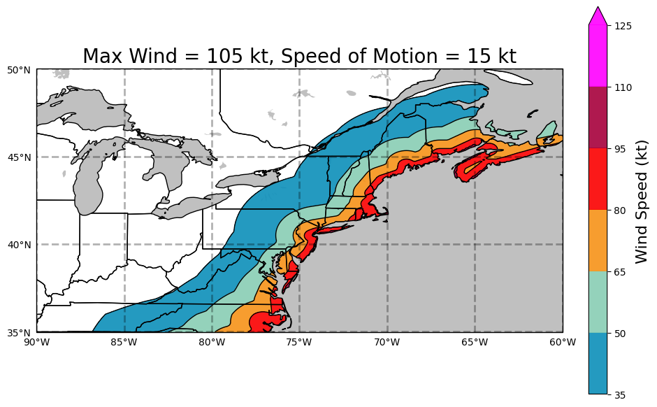
The inland wind model was developed by Mark DeMaria (NOAA/NWS/TPC) and John Kaplan (NOAA/AOML/HRD). The model applies a simple two parameter decay equation to the hurricane wind field at landfall to estimate the maximum sustained surface wind as a storm moves inland. This model can be used for operational forecasting of the maximum winds of landfalling tropical cyclones. It can also be used to estimate the maximum inland penetration of hurricane force winds (or any wind threshold) for a given initial storm intensity and forward storm motion. For further explanation refer to:
Kaplan, J., DeMaria, M., 1995: A Simple Empirical Model for Predicting the Decay of Tropical Cyclone Winds After Landfall. J. App. Meteor., 34, No. 11, 2499-2512.
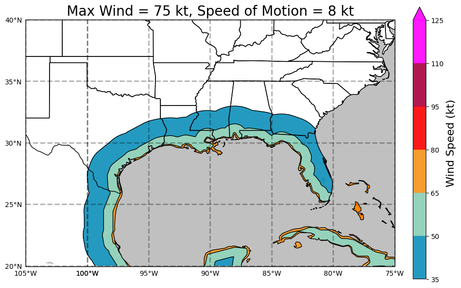
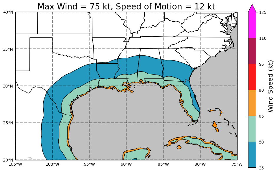
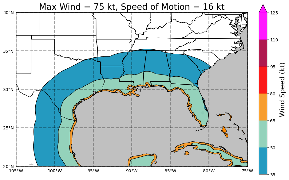
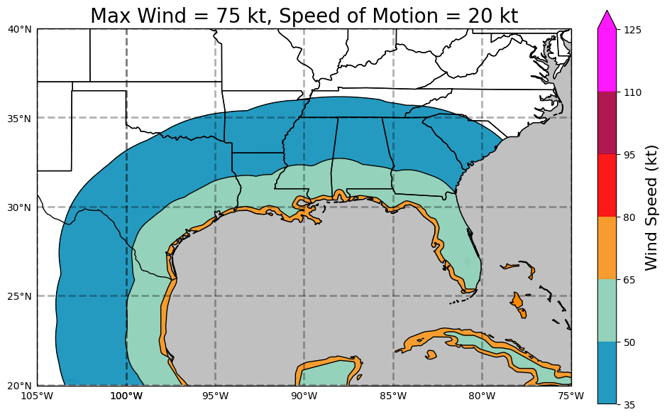
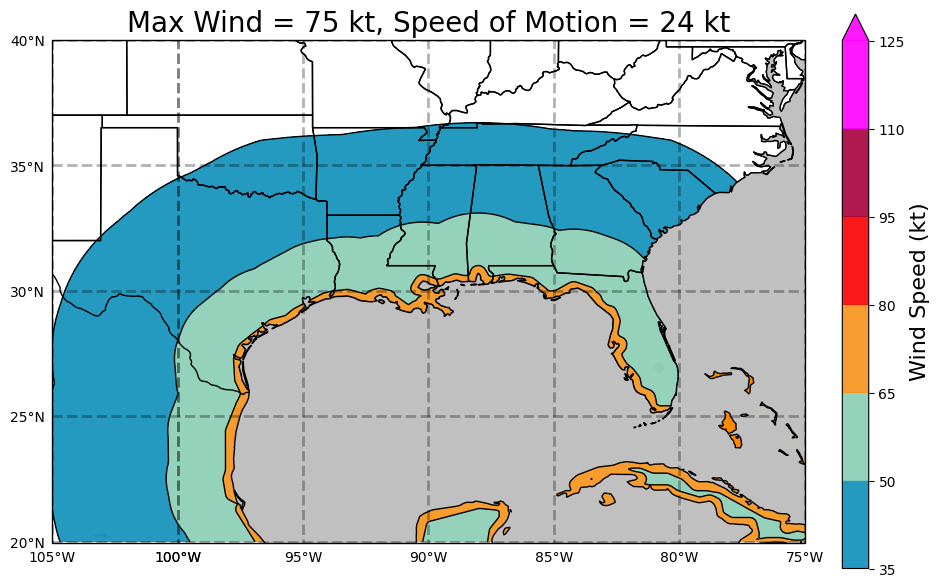
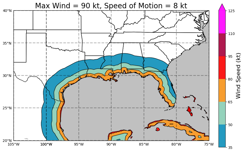
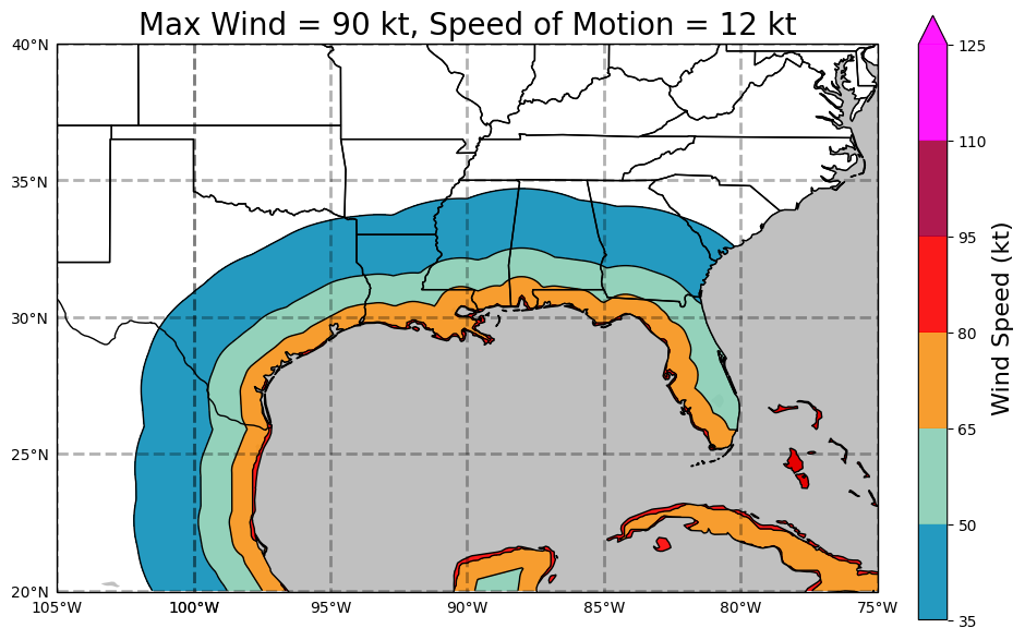
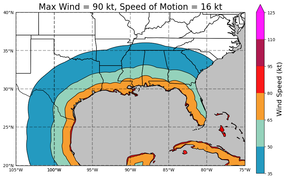
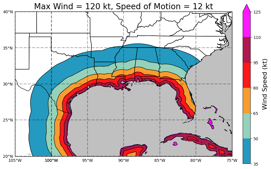
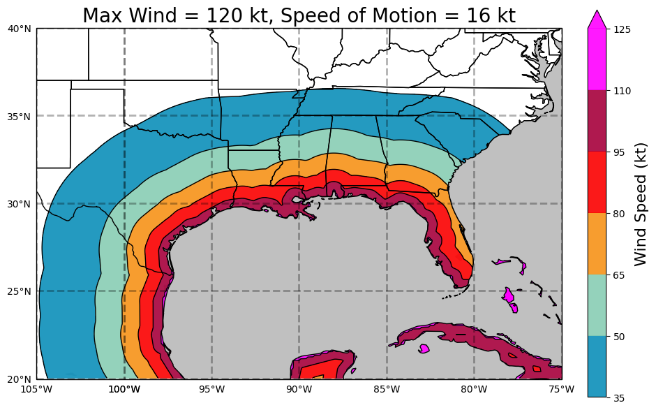
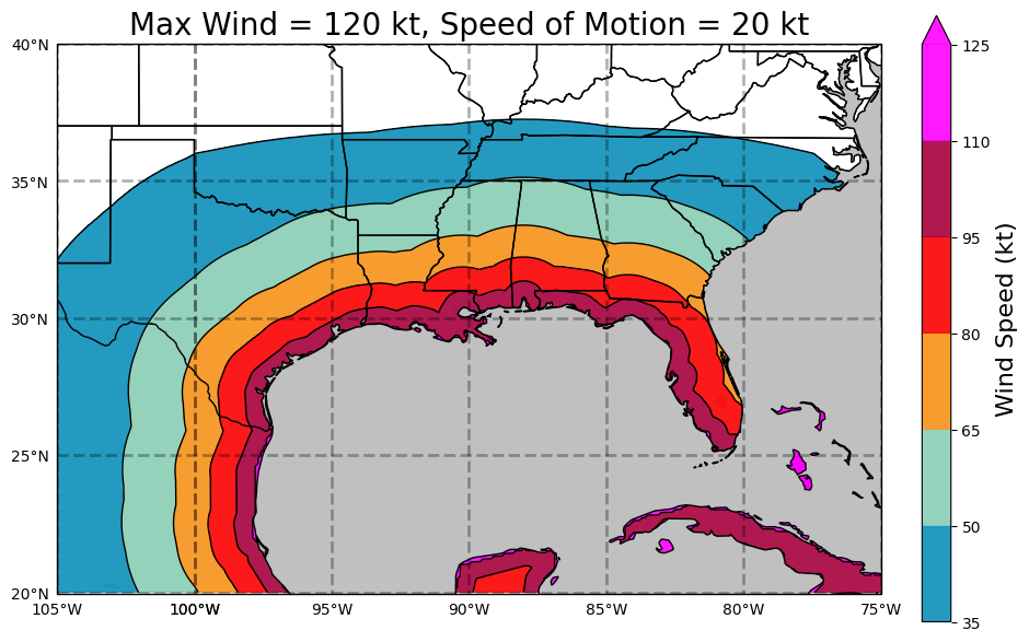
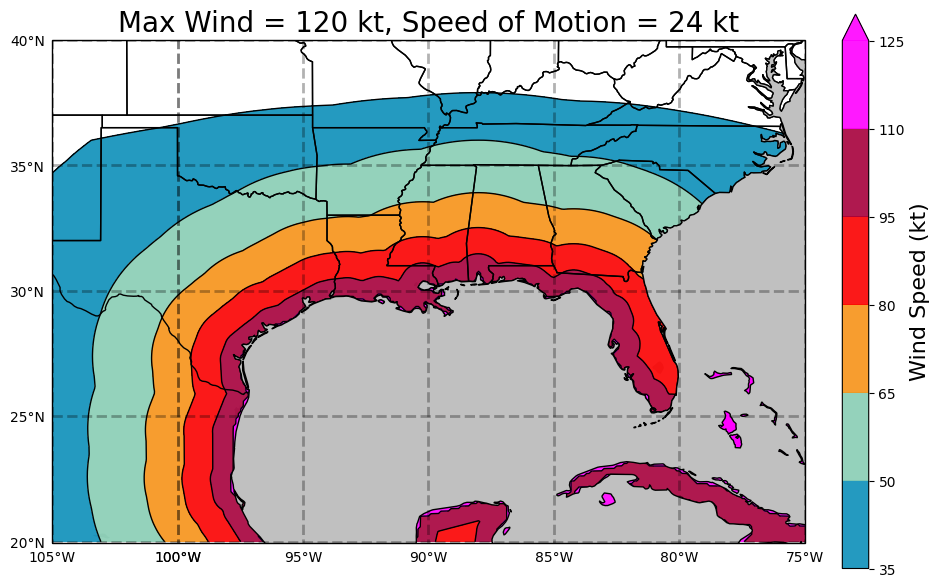
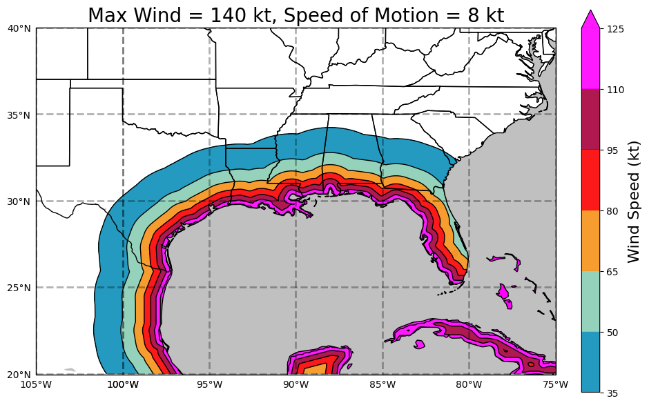
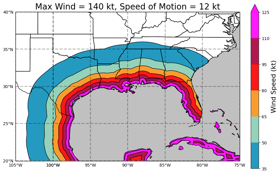
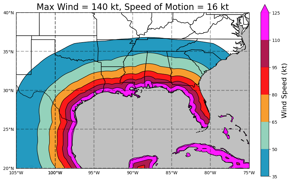
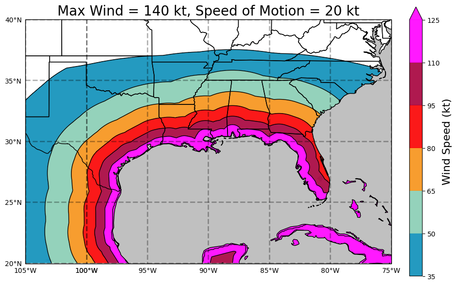
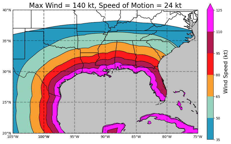
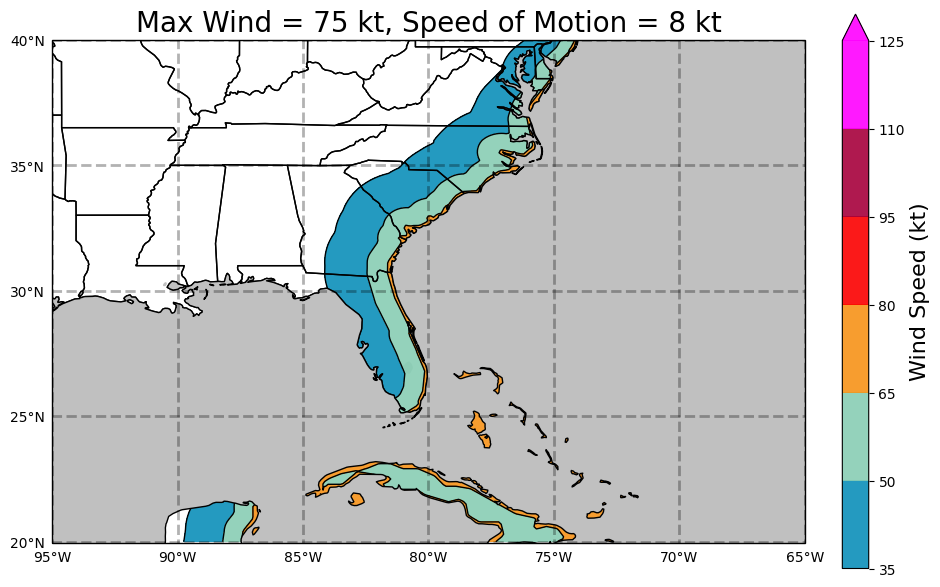
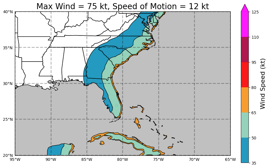
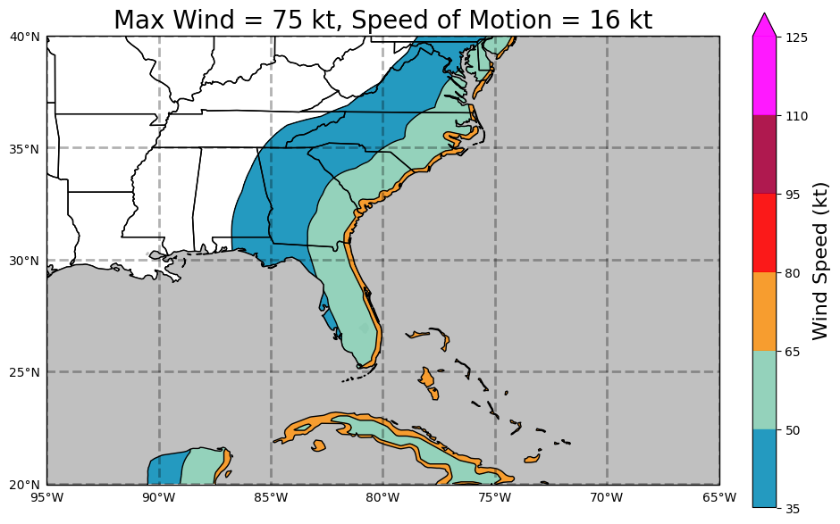
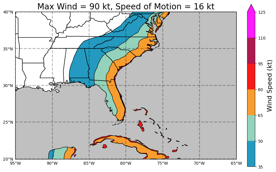
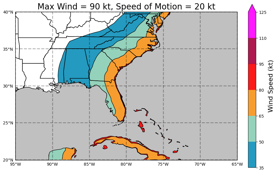
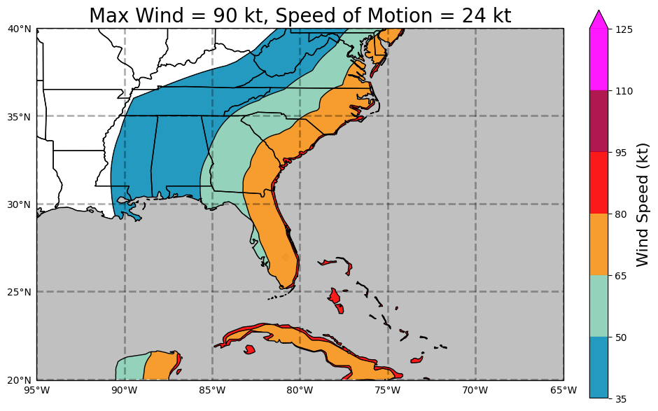
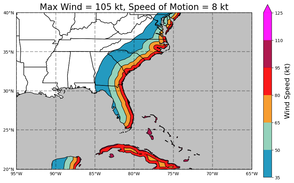
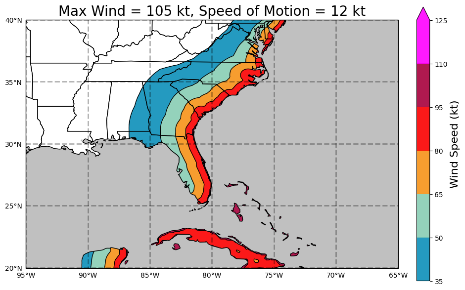
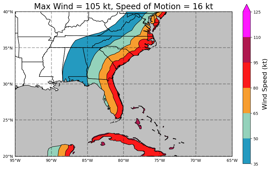
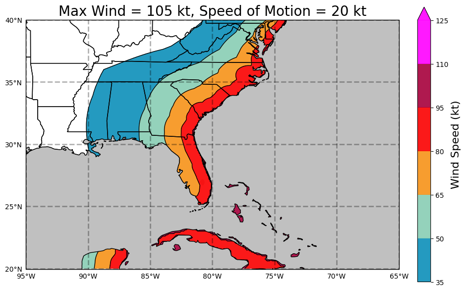
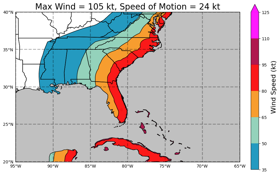
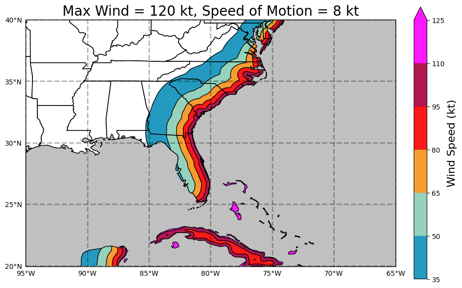
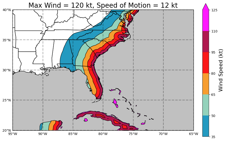
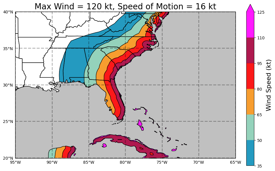
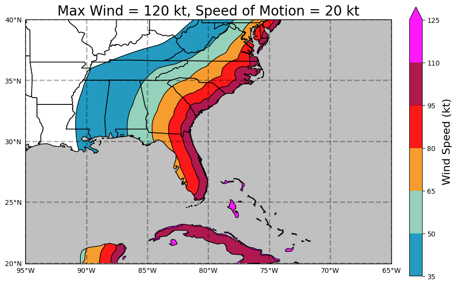
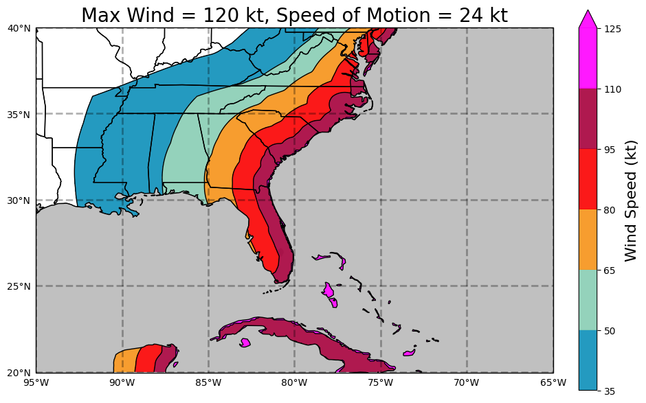
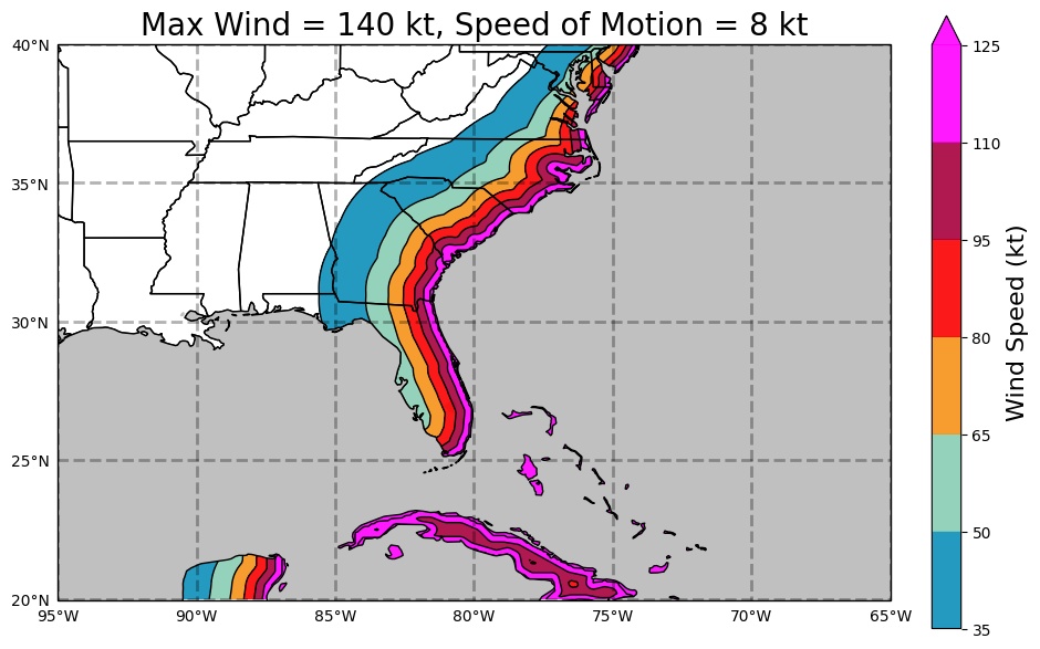
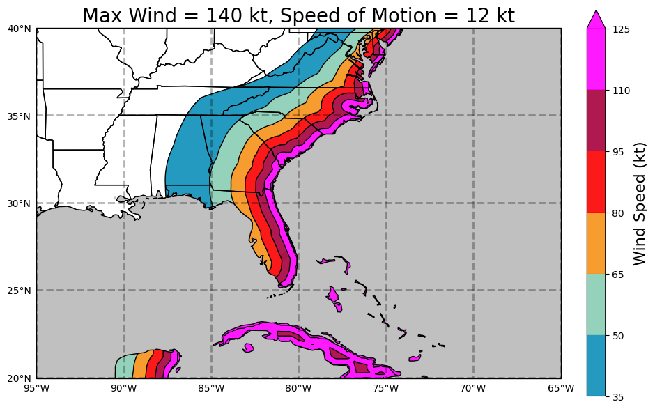
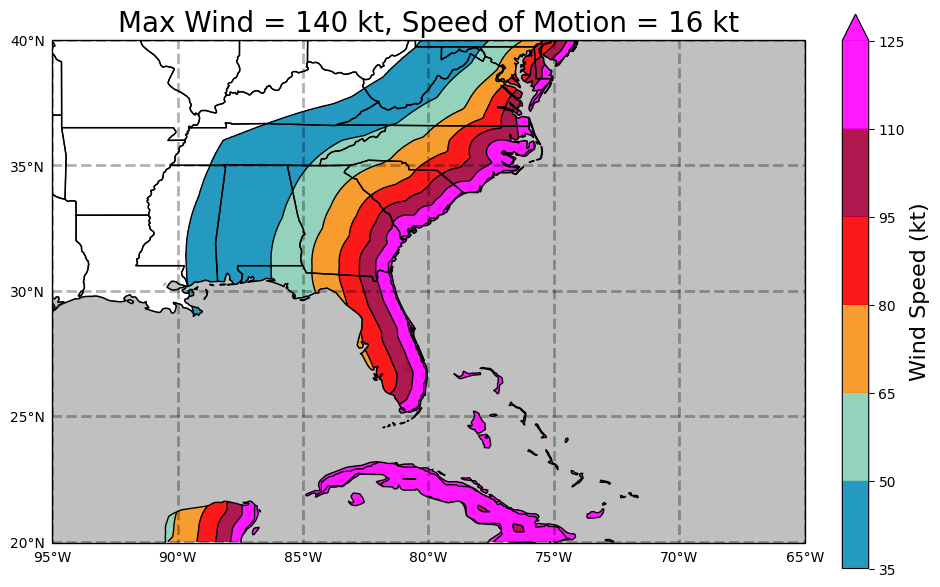
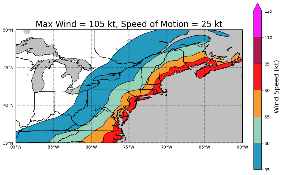
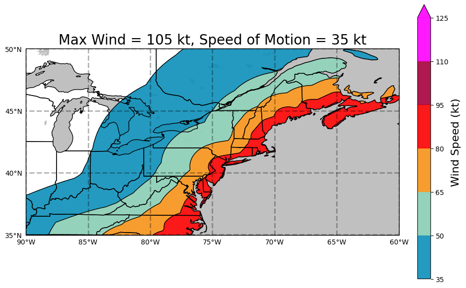
The tables below display examples of the Maximum Envelope of Winds. Three tables are shown, one for each of the regions: Gulf coast, East coast, and Northeast Coast. Click on the values to display the Maximum Envelope of Wind for a specific hurricane strength (as measured by the Saffir-Simpson Hurricane Wind Scale) and forward motion of a typical hurricane.
| Strength | Forward Motion (knots) | ||||
|---|---|---|---|---|---|
| Category 1 | 8 | 12 | 16 | 20 | 24 |
| Category 2 | 8 | 12 | 16 | 20 | 24 |
| Category 3 | 8 | 12 | 16 | 20 | 24 |
| Category 4 | 8 | 12 | 16 | 20 | 24 |
| Category 5 | 8 | 12 | 16 | 20 | 24 |
| Strength | Forward Motion (knots) | ||||
|---|---|---|---|---|---|
| Category 1 | 8 | 12 | 16 | 20 | 24 |
| Category 2 | 8 | 12 | 16 | 20 | 24 |
| Category 3 | 8 | 12 | 16 | 20 | 24 |
| Category 4 | 8 | 12 | 16 | 20 | 24 |
| Category 5 | 8 | 12 | 16 | 20 | 24 |
| Strength | Forward Motion (knots) | ||
|---|---|---|---|
| Category 1 | 15 | 25 | 35 |
| Category 2 | 15 | 25 | 35 |
| Category 3 | 15 | 25 | 35 |
Alternate Formats
About Alternates -
E-Mail Advisories -
RSS Feeds
Cyclone Forecasts
Latest Advisory -
Past Advisories -
About Advisories
Marine Forecasts
Latest Products -
About Marine Products
Tools & Data
Satellite Imagery -
US Weather Radar -
Aircraft Recon -
Local Data Archive -
Forecast Verification -
Deadliest/Costliest/Most Intense
Learn About Hurricanes
Storm Names
Wind Scale -
Prepare -
Climatology -
NHC Glossary -
NHC Acronyms -
Frequently Asked Questions -
AOML Hurricane-Research Division
About Us
About NHC -
Mission/Vision -
Other NCEP Centers -
NHC Staff -
Visitor Information -
NHC Library
NOAA/
National Weather Service
National Centers for Environmental Prediction
National Hurricane Center
11691 SW 17th Street
Miami, Florida, 33165-2149 USA
nhcwebmaster@noaa.gov
Disclaimer
Privacy Policy
Credits
About Us
Glossary
Career Opportunities
Page last modified: Friday, 15-Jan-2021 21:02:06 UTC