ZCZC MIATWOEP ALL
TTAA00 KNHC DDHHMM
Tropical Weather Outlook
NWS National Hurricane Center Miami FL
1100 AM PDT Wed Jun 14 2023
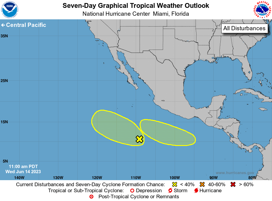
For the eastern North Pacific...east of 140 degrees west longitude:
1. Central East Pacific:
A broad area of disturbed weather is located several hundred miles
south of the southern tip of Baja California. Some slow development
of this system is possible over the next couple of days while it
moves generally west-northwestward at 10 to 15 mph. By this
weekend, conditions are expected to become unfavorable for
development.
* Formation chance through 48 hours...low...20 percent.
* Formation chance through 7 days...low...20 percent.
2. Eastern East Pacific:
An area of low pressure could form by this weekend several hundred
miles south of the southern coast of Mexico. Conditions appear
favorable for some development of this system thereafter while it
moves westward to west-northwestward at around 10 mph.
* Formation chance through 48 hours...low...near 0 percent.
* Formation chance through 7 days...low...20 percent.
Forecaster Pasch