Skip Navigation Links
NOAA NOAA United States Department of Commerce

NHC Graphical Outlook Archive


« Earliest Available         ‹ Earlier         Later ›         Latest Available »
GIS Shapefiles
Central Pacific Eastern Pacific Atlantic

View 2-Day Graphical Tropical Weather Outlook
Click for Atlantic Click for Atlantic

Tropical Weather Outlook Text

ZCZC MIATWOEP ALL
TTAA00 KNHC DDHHMM

Tropical Weather Outlook
NWS National Hurricane Center Miami FL
1100 PM PDT Fri Jun 16 2023

For the eastern North Pacific...east of 140 degrees west longitude:

1. Eastern East Pacific:
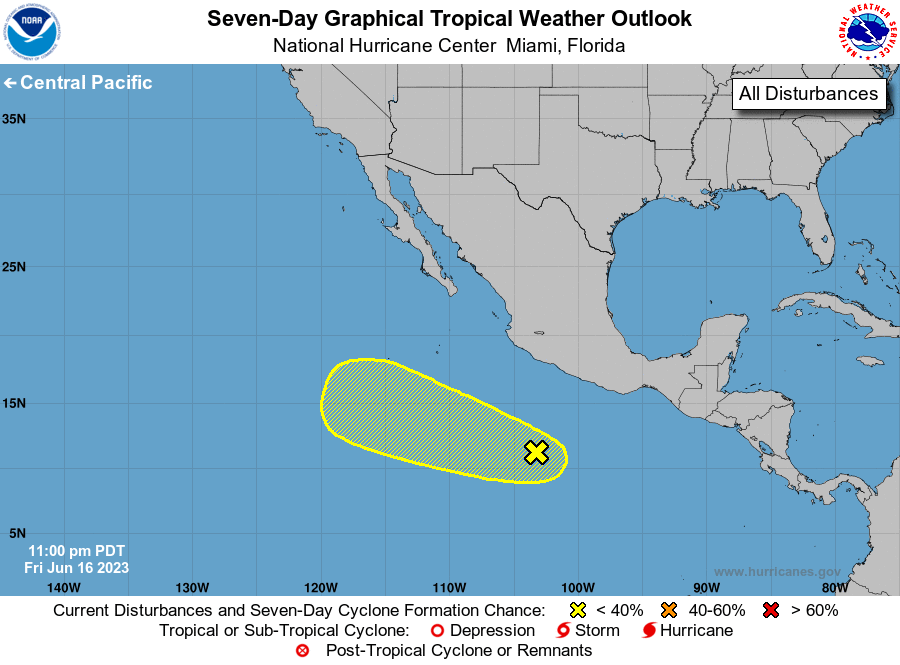
Showers and thunderstorms have increased somewhat in association 
with a tropical wave located several hundred miles south-southwest 
of southern Mexico. Some slow development is possible during the 
next few days while the system moves west-northwestward at about 10 
mph. However, the system is then expected to move into a more 
unfavorable environment by the middle portion of next week.
* Formation chance through 48 hours...low...20 percent.
* Formation chance through 7 days...low...30 percent.

Forecaster Papin


List of Atlantic Outlooks (May 2023 - Present)
List of East Pacific Outlooks (May 2023 - Present)
List of Central Pacific Outlooks (May 2023 - Present)
List of Atlantic Outlooks (July 2014 - April 2023)
List of East Pacific Outlooks (July 2014 - April 2023)
List of Central Pacific Outlooks (June 2019 - April 2023)
List of Atlantic Outlooks (June 2009 - June 2014)
List of East Pacific Outlooks (June 2009 - June 2014)