Skip Navigation Links
NOAA NOAA United States Department of Commerce

NHC Graphical Outlook Archive


« Earliest Available         ‹ Earlier         Later ›         Latest Available »
GIS Shapefiles
Central Pacific Eastern Pacific Atlantic

View 2-Day Graphical Tropical Weather Outlook
Click for Atlantic Click for Atlantic

Tropical Weather Outlook Text

ZCZC MIATWOEP ALL
TTAA00 KNHC DDHHMM

Tropical Weather Outlook
NWS National Hurricane Center Miami FL
500 AM PDT Sun Jun 18 2023

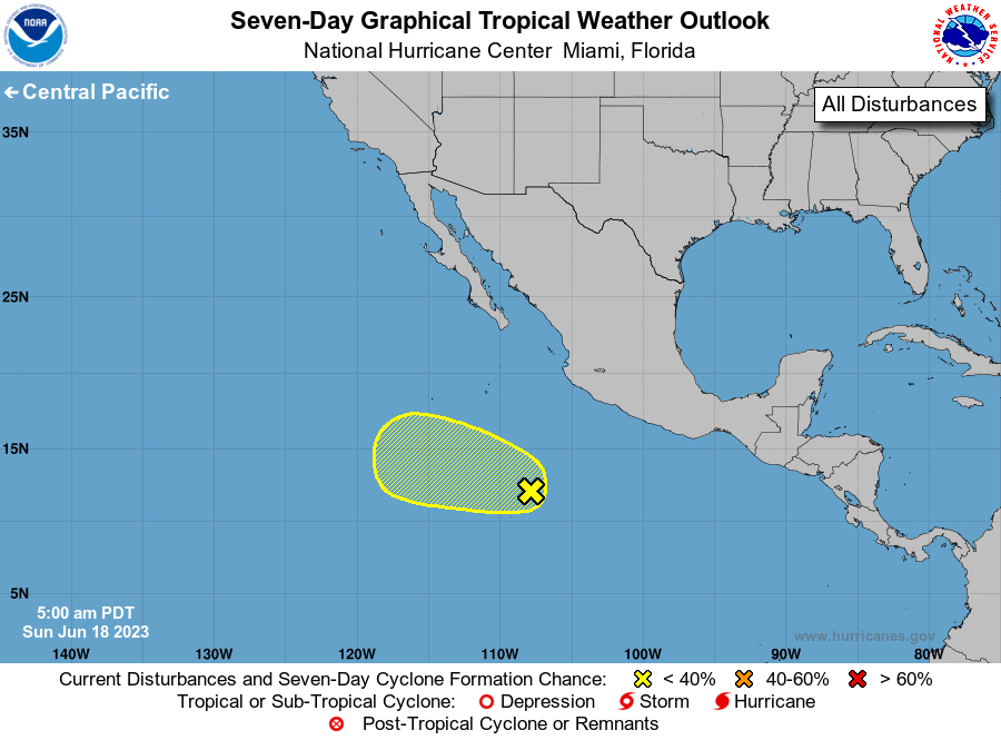
For the eastern North Pacific...east of 140 degrees west longitude:

1. Central East Pacific (EP90):
A tropical wave continues to produce disorganized showers and 
thunderstorms several hundred miles to the south of the southern 
tip of Baja California.  Some slow development of this system 
remains possible during the next couple of days while it moves 
west-northwestward at about 10 mph.  Thereafter, the environment  
is expected to become unfavorable for development.
* Formation chance through 48 hours...low...20 percent.
* Formation chance through 7 days...low...20 percent.

Forecaster Pasch


List of Atlantic Outlooks (May 2023 - Present)
List of East Pacific Outlooks (May 2023 - Present)
List of Central Pacific Outlooks (May 2023 - Present)
List of Atlantic Outlooks (July 2014 - April 2023)
List of East Pacific Outlooks (July 2014 - April 2023)
List of Central Pacific Outlooks (June 2019 - April 2023)
List of Atlantic Outlooks (June 2009 - June 2014)
List of East Pacific Outlooks (June 2009 - June 2014)