ZCZC MIATWOEP ALL
TTAA00 KNHC DDHHMM
Tropical Weather Outlook
NWS National Hurricane Center Miami FL
1100 AM PDT Sat Jun 24 2023
For the eastern North Pacific...east of 140 degrees west longitude:
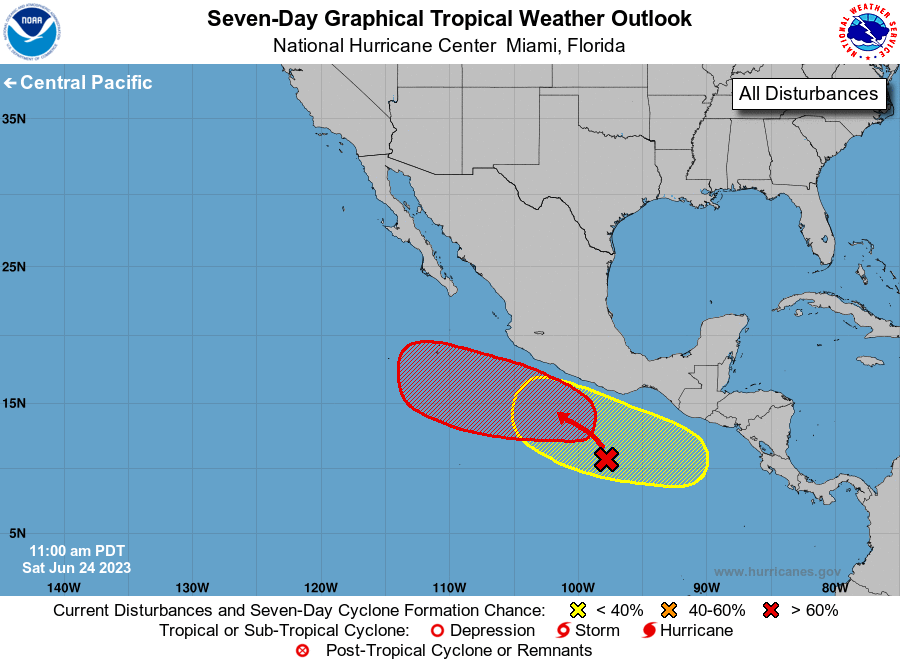
1. Off the Southwestern Coast of Mexico:
An elongated trough of low pressure located several hundred miles
south of the southwestern coast of Mexico continues to produce a
large area of disorganized showers and thunderstorms. Environmental
conditions appear conducive for development of this system, and a
tropical depression is expected to form during the early to middle
part of next week while it moves generally west-northwestward,
parallel to the southwestern coast of Mexico.
* Formation chance through 48 hours...low...30 percent.
* Formation chance through 7 days...high...90 percent.
2. South of Southern Mexico:
An area of low pressure could form early next week several hundred
miles south of El Salvador, Guatemala, and southern Mexico. Some
gradual development of this system is possible thereafter as it
moves slowly west-northwestward, remaining offshore of the southern
coast of Mexico.
* Formation chance through 48 hours...low...near 0 percent.
* Formation chance through 7 days...low...30 percent.
Forecaster Papin