ZCZC MIATWOEP ALL
TTAA00 KNHC DDHHMM
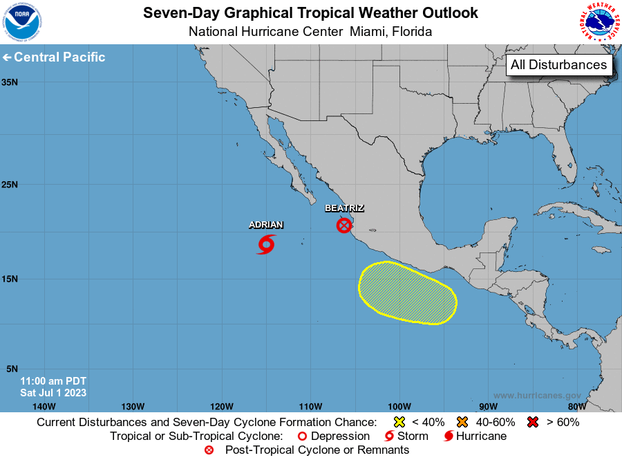
Tropical Weather Outlook
NWS National Hurricane Center Miami FL
1100 AM PDT Sat Jul 1 2023
For the eastern North Pacific...east of 140 degrees west longitude:
Active Systems:
The National Hurricane Center is issuing advisories on recently
downgraded Tropical Storm Adrian, located several hundred miles
southwest of the southern tip of the Baja California peninsula, and
has issued the last advisory on the remnants of Beatriz, located
near the coast of west-central Mexico.
1. Offshore of Southern Mexico:
A broad area of low pressure could form several hundred miles off
the coast of southern Mexico during the latter part of next week.
Some gradual development of this system is possible thereafter as it
moves generally west-northwestward, roughly parallel to the coasts
of southern and southwestern Mexico.
* Formation chance through 48 hours...low...near 0 percent.
* Formation chance through 7 days...low...20 percent.
Forecaster Reinhart