ZCZC MIATWOEP ALL
TTAA00 KNHC DDHHMM
Tropical Weather Outlook
NWS National Hurricane Center Miami FL
1100 PM PDT Sat Jul 1 2023
For the eastern North Pacific...east of 140 degrees west longitude:
Active Systems:
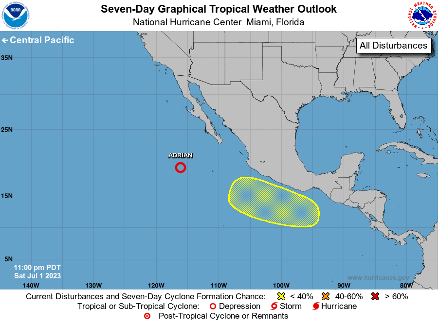
The National Hurricane Center is issuing advisories on Tropical
Storm Adrian, located several hundred miles west-southwest of the
southern tip of the Baja California peninsula.
1. Offshore of Southern Mexico:
A broad area of low pressure could form several hundred miles off
the coast of southern Mexico during the middle to latter part of
next week. Thereafter, environmental conditions are forecast to be
favorable for gradual development of this system while it moves
generally west-northwestward, roughly parallel to the coasts of
southern and southwestern Mexico.
* Formation chance through 48 hours...low...near 0 percent.
* Formation chance through 7 days...low...30 percent.
Forecaster Papin