ZCZC MIATWOEP ALL
TTAA00 KNHC DDHHMM
Tropical Weather Outlook
NWS National Hurricane Center Miami FL
1100 AM PDT Thu Jul 6 2023
For the eastern North Pacific...east of 140 degrees west longitude:
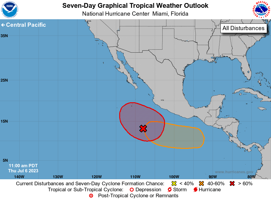
1. Offshore of Southwestern Mexico (EP93):
A broad area of low pressure located several hundred miles south of
southwestern Mexico is producing disorganized showers and
thunderstorms. Environmental conditions are forecast to be
conducive for gradual development of this system, and a tropical
depression will likely form over the weekend while it moves
generally west-northwestward, away from the coast of mainland
Mexico.
* Formation chance through 48 hours...high...70 percent.
* Formation chance through 7 days...high...80 percent.
2. Offshore of Southern Mexico:
A broad area of low pressure could form a few hundred miles south
of the southern coast of Mexico early next week. Some gradual
development of this system is possible thereafter while it moves
generally westward to west-northwestward.
* Formation chance through 48 hours...low...near 0 percent.
* Formation chance through 7 days...medium...50 percent.
Forecaster Roberts