ZCZC MIATWOEP ALL
TTAA00 KNHC DDHHMM
Tropical Weather Outlook
NWS National Hurricane Center Miami FL
500 PM PDT Mon Jul 10 2023
For the eastern North Pacific...east of 140 degrees west longitude:
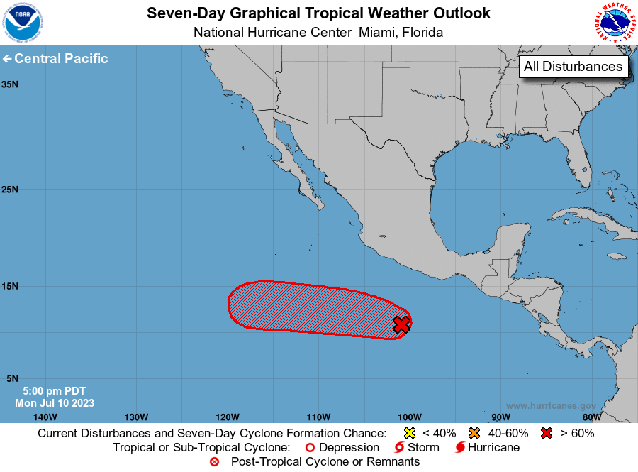
1. Offshore of Southern Mexico (EP94):
Shower and thunderstorm activity is becoming better organized in
association with an area of low pressure located a few hundred miles
south of the southern coast of Mexico. Environmental conditions
appear conducive for additional development, and a tropical
depression is likely to form during the next couple of days. The
system is expected to move westward to west-northwestward over the
next several days, remaining well offshore of the coast of Mexico.
* Formation chance through 48 hours...high...70 percent.
* Formation chance through 7 days...high...90 percent.
Forecaster Beven