ZCZC MIATWOEP ALL
TTAA00 KNHC DDHHMM
Tropical Weather Outlook
NWS National Hurricane Center Miami FL
500 AM PDT Fri Jul 28 2023
For the eastern North Pacific...east of 140 degrees west longitude:
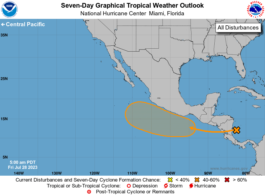
1. Offshore of Southern Mexico:
A tropical wave located over the southwestern Caribbean Sea is
producing a large area of showers and thunderstorms. The system is
expected to move across Central America and over the eastern Pacific
during the next day or so, and an area of low pressure is expected
to form off the coast of southern Mexico later this weekend.
Thereafter, some gradual development of this system is possible and
a tropical depression could form while it moves generally
west-northwestward at 10 to 15 mph, roughly parallel to the coasts
of southern and southwestern Mexico.
* Formation chance through 48 hours...low...10 percent.
* Formation chance through 7 days...medium...60 percent.
Forecaster Bucci