Skip Navigation Links
NOAA NOAA United States Department of Commerce

NHC Graphical Outlook Archive


« Earliest Available         ‹ Earlier         Later ›         Latest Available »
GIS Shapefiles
Central Pacific Eastern Pacific Atlantic

View 2-Day Graphical Tropical Weather Outlook
Click for Atlantic Click for Atlantic

Tropical Weather Outlook Text

ZCZC MIATWOEP ALL
TTAA00 KNHC DDHHMM

Tropical Weather Outlook
NWS National Hurricane Center Miami FL
500 AM PDT Sun Jul 30 2023

For the eastern North Pacific...east of 140 degrees west longitude:

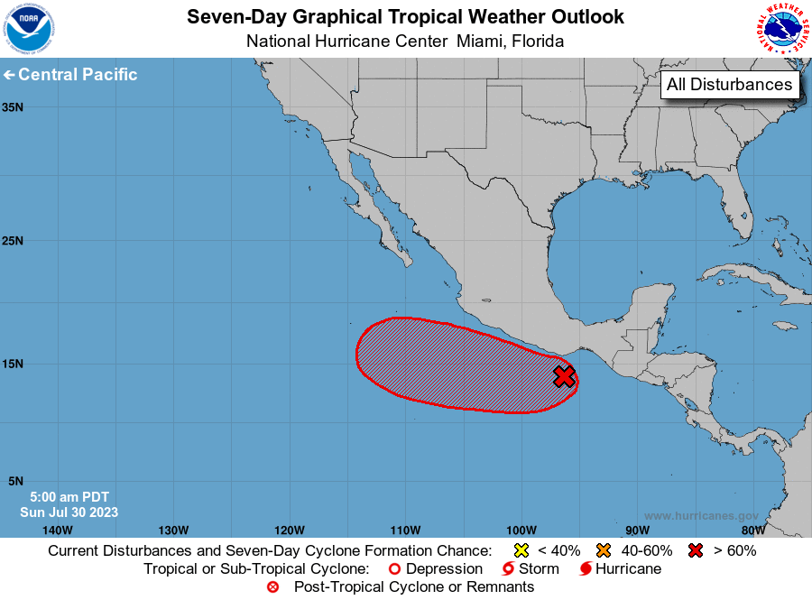
1. Offshore of Southern Mexico (EP96):
An area of disorganized showers and thunderstorms located south of 
the southern coast of Mexico is associated with a tropical wave and 
broad area of low pressure.  Environmental conditions are favorable 
for gradual development, and a tropical depression will likely form 
early this week while the system moves west-northwestward at near  
15 mph, roughly parallel to the coasts of southern and southwestern 
Mexico.
* Formation chance through 48 hours...medium...60 percent.
* Formation chance through 7 days...high...80 percent.

Forecaster Pasch


List of Atlantic Outlooks (May 2023 - Present)
List of East Pacific Outlooks (May 2023 - Present)
List of Central Pacific Outlooks (May 2023 - Present)
List of Atlantic Outlooks (July 2014 - April 2023)
List of East Pacific Outlooks (July 2014 - April 2023)
List of Central Pacific Outlooks (June 2019 - April 2023)
List of Atlantic Outlooks (June 2009 - June 2014)
List of East Pacific Outlooks (June 2009 - June 2014)