ZCZC MIATWOEP ALL
TTAA00 KNHC DDHHMM
Tropical Weather Outlook
NWS National Hurricane Center Miami FL
500 AM PDT Wed Aug 2 2023
For the eastern North Pacific...east of 140 degrees west longitude:
Active Systems:
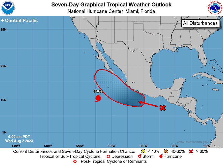
The National Hurricane Center is issuing advisories on Hurricane
Dora, located a little more than 500 miles south-southwest of the
southern tip of the Baja California Peninsula.
1. Off the coast of Southern Mexico:
A tropical wave located south of the Gulf of Tehuantepec is
associated with a broad area of disorganized showers and
thunderstorms. This feature is soon expected to lead to the
development of an area of low pressure, where environmental
conditions appear favorable for further development. A tropical
depression is now likely to form by this weekend. This system is
forecast to move west-northwestward or northwestward, moving
parallel to but not far off the southwestern coast of Mexico.
* Formation chance through 48 hours...low...20 percent.
* Formation chance through 7 days...high...70 percent.
Forecaster Papin