ZCZC MIATWOEP ALL
TTAA00 KNHC DDHHMM
Tropical Weather Outlook
NWS National Hurricane Center Miami FL
1100 AM PDT Wed Aug 2 2023
For the eastern North Pacific...east of 140 degrees west longitude:
Active Systems:
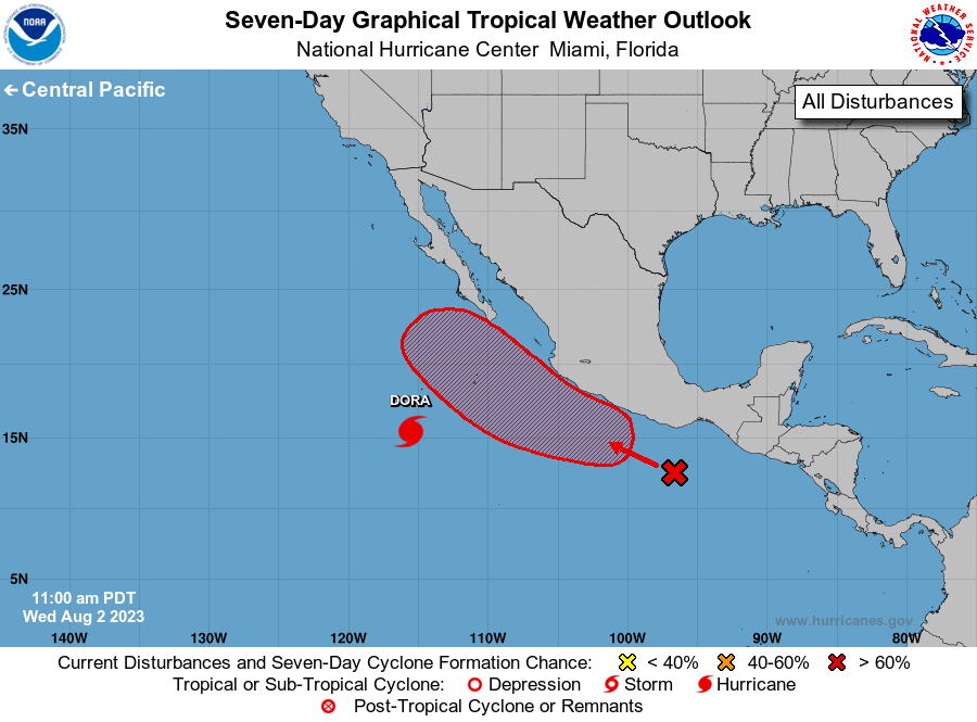
The National Hurricane Center is issuing advisories on Hurricane
Dora, located about 600 miles south-southwest of the southern tip of
the Baja California Peninsula.
1. Off the coast of Southern Mexico:
A broad area of disorganized showers and thunderstorms located
several hundred miles south of the Gulf of Tehuantepec are
associated with a tropical wave. An area of low pressure is expected
to develop from this feature in the next day or two, where
environmental conditions appear favorable for further development. A
tropical depression is likely to form by this weekend as this system
moves west-northwestward or northwestward, moving parallel to but
not far off the southwestern coast of Mexico.
* Formation chance through 48 hours...low...30 percent.
* Formation chance through 7 days...high...70 percent.
Forecaster Papin