ZCZC MIATWOEP ALL
TTAA00 KNHC DDHHMM
Tropical Weather Outlook
NWS National Hurricane Center Miami FL
1100 AM PDT Fri Aug 4 2023
For the eastern North Pacific...east of 140 degrees west longitude:
Active Systems:
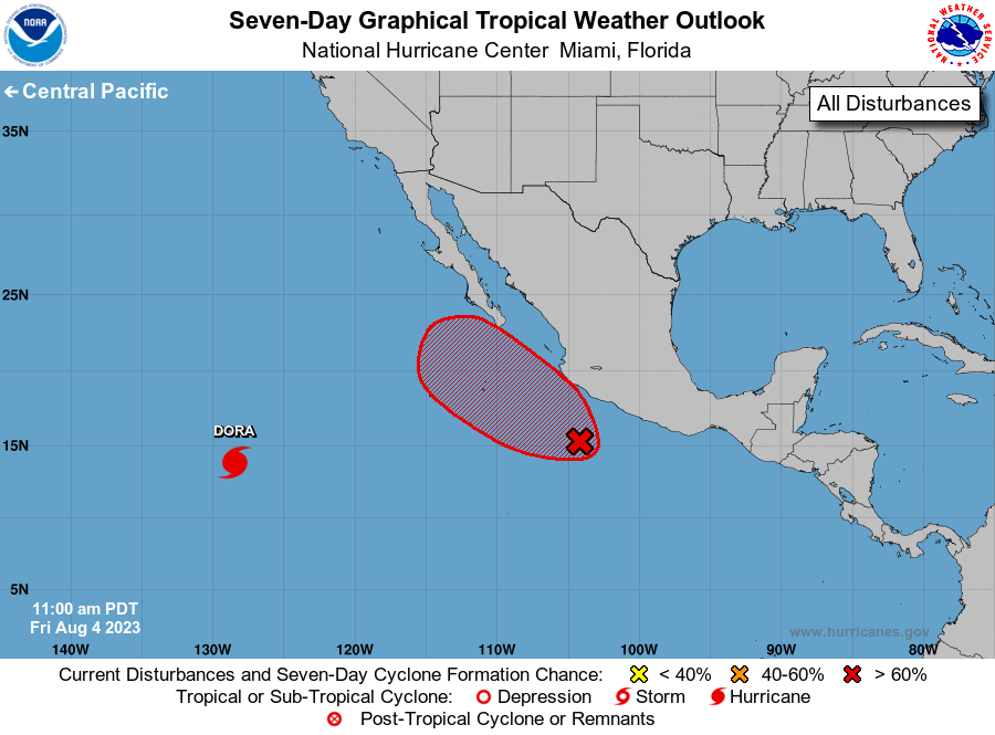
The National Hurricane Center is issuing advisories on Hurricane
Dora, located over a thousand miles west-southwest of the southern
tip of the Baja California Peninsula.
1. Off the coast of Southwestern Mexico:
Showers and thunderstorms associated with a broad area of low
pressure located about 250 miles south-southeast of Manzanillo,
Mexico, have become better organized over the past several hours.
Environmental conditions appear conducive for further development
and a tropical depression is likely to form during the next day or
so as it moves west-northwestward or northwestward, parallel to but
not far offshore of the southwestern coast of Mexico. Interests
along the southwestern coast of Mexico and the southern portion of
the Baja California peninsula should monitor the progress of this
system during the next few days.
* Formation chance through 48 hours...high...80 percent.
* Formation chance through 7 days...high...90 percent.
Forecaster Beven