ZCZC MIATWOEP ALL
TTAA00 KNHC DDHHMM
Tropical Weather Outlook
NWS National Hurricane Center Miami FL
500 PM PDT Fri Aug 4 2023
For the eastern North Pacific...east of 140 degrees west longitude:
Active Systems:
The National Hurricane Center is issuing advisories on Hurricane
Dora, located more than 1300 miles west-southwest of the southern
tip of the Baja California Peninsula.
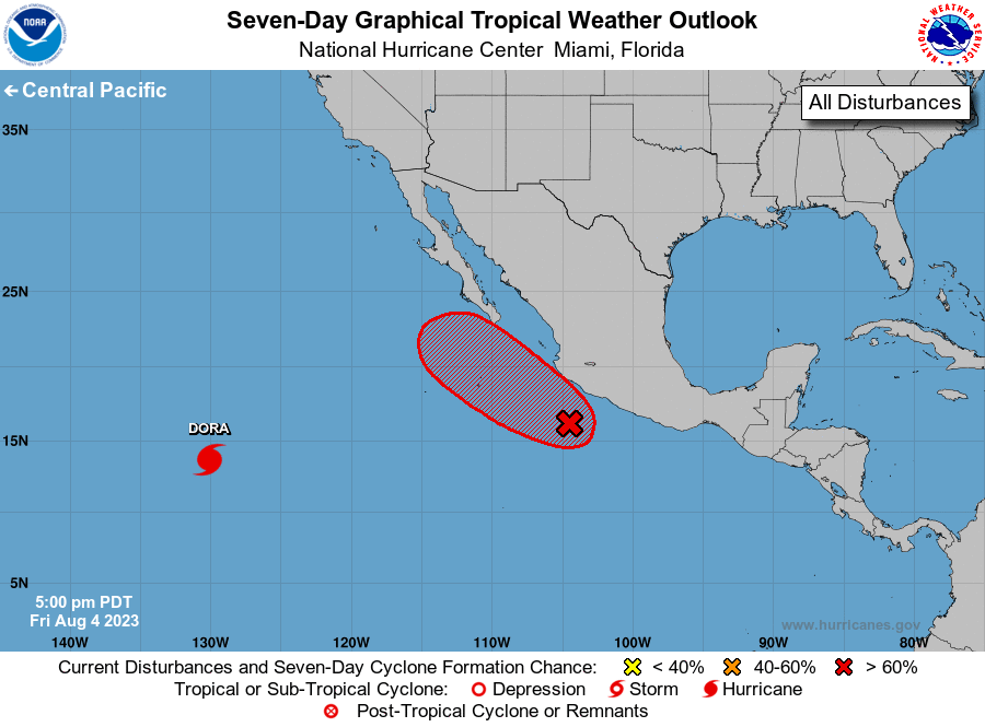
1. Off the coast of Southwestern Mexico (EP97):
Showers and thunderstorms continue to show signs of organization in
association with a broad area of low pressure located a couple of
hundred miles south of Manzanillo, Mexico. Satellite data suggest
the circulation of the system is becoming better defined, and a
tropical depression is likely to form later tonight or on Saturday
as it moves generally northwestward at about 15 mph, parallel to but
not far offshore of the southwestern coast of Mexico. Interests
along the southwestern coast of Mexico and the southern portion of
the Baja California peninsula should monitor the progress of this
system during the next few days.
* Formation chance through 48 hours...high...90 percent.
* Formation chance through 7 days...high...90 percent.
Forecaster Reinhart