ZCZC MIATWOEP ALL
TTAA00 KNHC DDHHMM
Tropical Weather Outlook
NWS National Hurricane Center Miami FL
500 AM PDT Thu Aug 17 2023
For the eastern North Pacific...east of 140 degrees west longitude:
Active Systems:
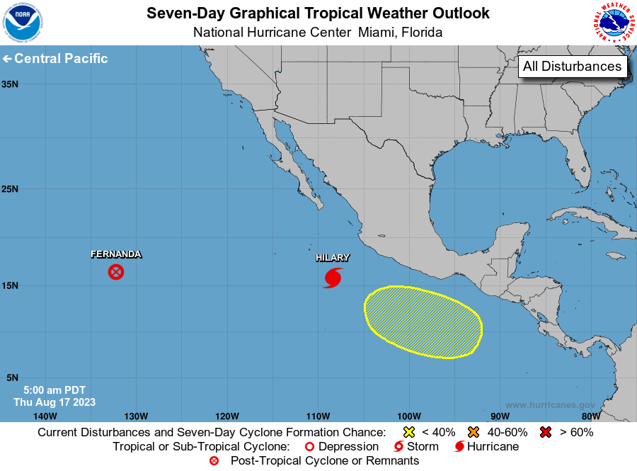
The National Hurricane Center is issuing advisories on Tropical
Storm Fernanda, located well to the west-southwest of the southern
tip of the Baja California peninsula, and on Hurricane Hilary,
located several hundred miles south-southeast of the southern tip of
Baja California peninsula.
1. South of Southern Mexico:
A broad area of low pressure could form offshore of the coast of
southern Mexico during the early or middle part of next week. Some
gradual development of this system is possible thereafter while it
moves slowly west-northwestward or northwestward.
* Formation chance through 48 hours...low...near 0 percent.
* Formation chance through 7 days...low...20 percent.
Public Advisories on Hilary are issued under WMO header WTPZ34 KNHC
and under AWIPS header MIATCPEP4.
Forecast/Advisories on Hilary are issued under WMO header WTPZ24
KNHC and under AWIPS header MIATCMEP4.
Forecaster Bucci