ZCZC MIATWOEP ALL
TTAA00 KNHC DDHHMM
Tropical Weather Outlook
NWS National Hurricane Center Miami FL
1100 AM PDT Fri Aug 18 2023
For the eastern North Pacific...east of 140 degrees west longitude:
Active Systems:
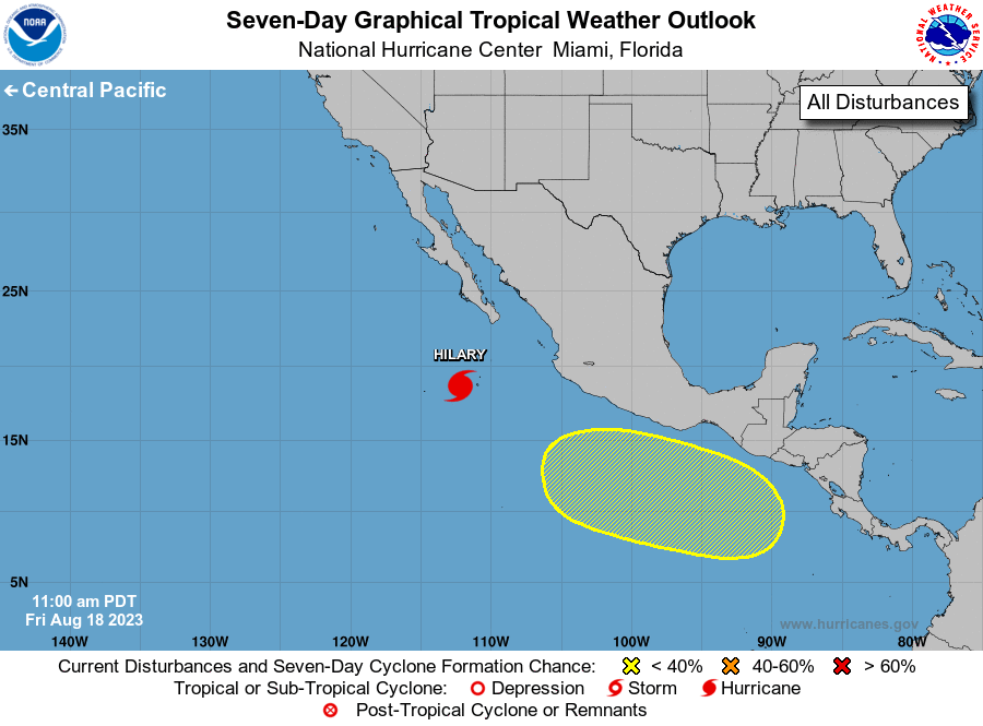
The National Hurricane Center is issuing advisories on Hurricane
Hilary, located less than 400 miles south-southwest of the southern
tip of the Baja California peninsula.
1. South of Southern Mexico:
A broad area of low pressure could form offshore of the coast of
southern Mexico early next week. Some gradual development of this
system is possible thereafter while it moves slowly toward the
west-northwest or northwest, generally parallel to the coast of
southern and southwestern Mexico.
* Formation chance through 48 hours...low...near 0 percent.
* Formation chance through 7 days...low...30 percent.
Forecaster Hagen/Bucci