ZCZC MIATWOEP ALL
TTAA00 KNHC DDHHMM
Tropical Weather Outlook
NWS National Hurricane Center Miami FL
1100 AM PDT Mon Aug 21 2023
For the eastern North Pacific...east of 140 degrees west longitude:
Active Systems:
The Weather Prediction Center is issuing advisories on Post-Tropical
Cyclone Hilary, located over the United States Rocky Mountains.
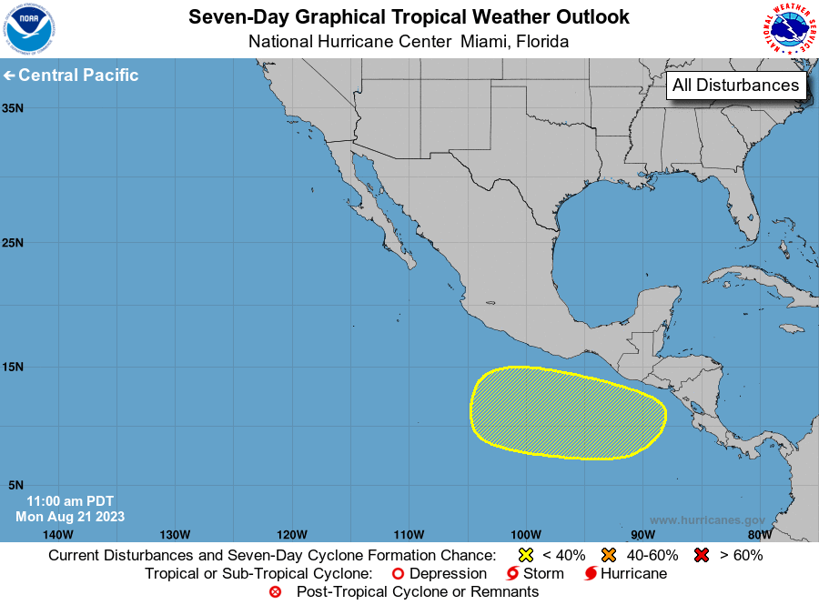
1. South of Southern Mexico:
A broad area of low pressure is expected to form offshore of the
coast of Central America or southern Mexico during the next few
days. Any subsequent development of this system should be slow to
occur while it drifts toward the northwest or north-northwest.
* Formation chance through 48 hours...low...near 0 percent.
* Formation chance through 7 days...low...30 percent.
Future information on Hilary can be found in Public Advisories
issued by the Weather Prediction Center under AWIPS header TCPEP4,
WMO header WTPZ34 KWNH, and on the web at www.hurricanes.gov.
Forecaster Papin