ZCZC MIATWOEP ALL
TTAA00 KNHC DDHHMM
Tropical Weather Outlook
NWS National Hurricane Center Miami FL
1100 AM PDT Sat Aug 26 2023
For the eastern North Pacific...east of 140 degrees west longitude:
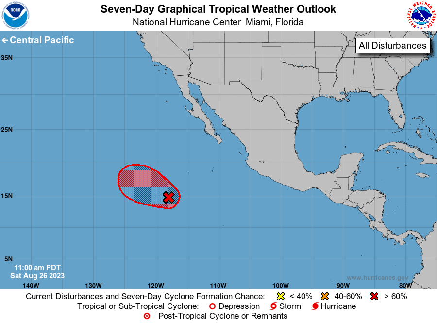
1. Central East Pacific (EP92):
Showers and thunderstorms continue to show signs of organization in
association with a low pressure system located about 700 miles
south-southwest of the southern tip of the Baja California
Peninsula. Environmental conditions are conducive for additional
development, and a tropical depression or storm is expected to form
in the next day or so while the system moves west-northwestward or
northwestward at 10 to 15 mph over the central portion of the
tropical eastern Pacific. For additional information on this
system, including gale warnings, see High Seas Forecast issued by
the National Weather Service.
* Formation chance through 48 hours...high...90 percent.
* Formation chance through 7 days...high...90 percent.
High Seas Forecasts issued by the National Weather Service
can be found under AWIPS header NFDHSFEPI, WMO header FZPN02
KWBC, and on the web at ocean.weather.gov/shtml/NFDHSFEPI.php
Forecaster Kelly/Pasch