Skip Navigation Links
NOAA NOAA United States Department of Commerce

NHC Graphical Outlook Archive


« Earliest Available         ‹ Earlier         Later ›         Latest Available »
GIS Shapefiles
Central Pacific Eastern Pacific Atlantic

View 2-Day Graphical Tropical Weather Outlook
Click for Atlantic Click for Atlantic

Tropical Weather Outlook Text

ZCZC MIATWOEP ALL
TTAA00 KNHC DDHHMM

Tropical Weather Outlook
NWS National Hurricane Center Miami FL
1100 PM PDT Sat Sep 2 2023

For the eastern North Pacific...east of 140 degrees west longitude:

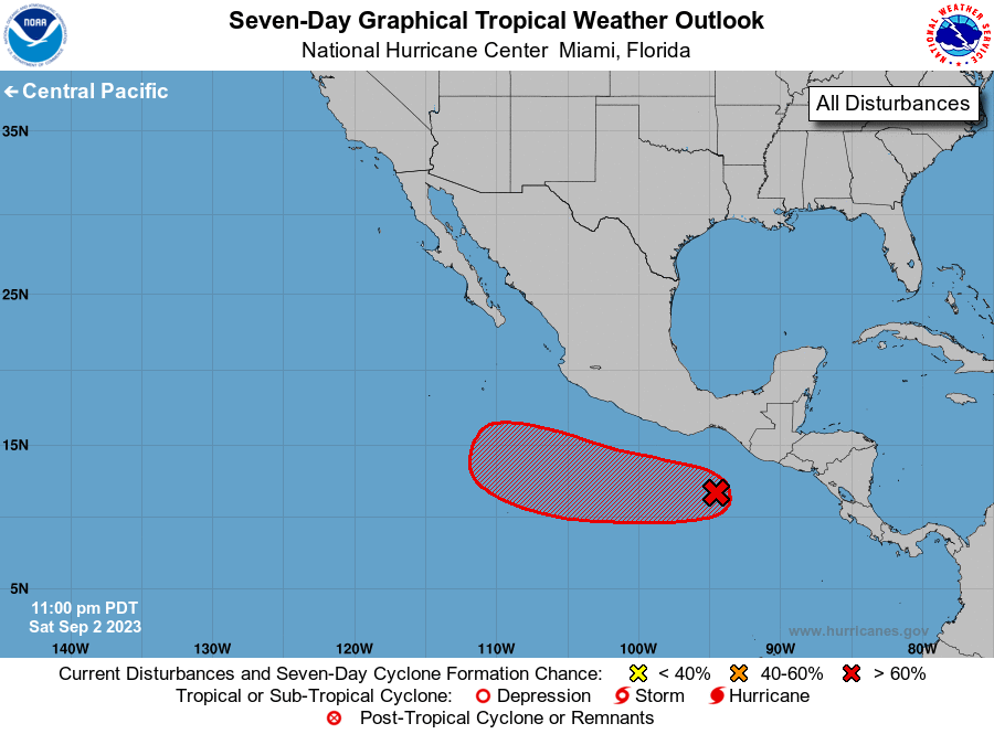
1. Central East Pacific: 
A tropical wave is producing limited shower and thunderstorm 
activity a couple of hundred miles south of the coast of southern 
Mexico.  Environmental conditions, however, are forecast to be 
conducive for gradual development of this system, and a tropical 
depression is expected to form by the middle of next week.  The 
system is forecast to move westward to west-northwestward, passing 
well south of mainland Mexico. 
* Formation chance through 48 hours...low...30 percent.
* Formation chance through 7 days...high...90 percent.

Forecaster Roberts


List of Atlantic Outlooks (May 2023 - Present)
List of East Pacific Outlooks (May 2023 - Present)
List of Central Pacific Outlooks (May 2023 - Present)
List of Atlantic Outlooks (July 2014 - April 2023)
List of East Pacific Outlooks (July 2014 - April 2023)
List of Central Pacific Outlooks (June 2019 - April 2023)
List of Atlantic Outlooks (June 2009 - June 2014)
List of East Pacific Outlooks (June 2009 - June 2014)