ZCZC MIATWOEP ALL
TTAA00 KNHC DDHHMM
Tropical Weather Outlook
NWS National Hurricane Center Miami FL
500 PM PDT Tue Sep 12 2023
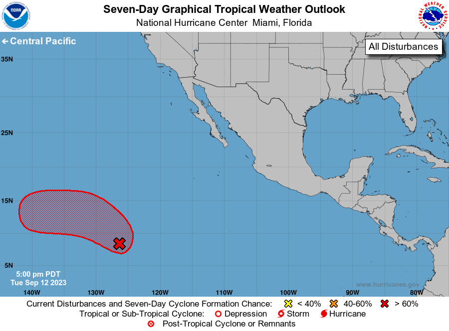
For the eastern North Pacific...east of 140 degrees west longitude:
1. Western East Pacific:
Shower and thunderstorm activity associated with a tropical wave
located well southwest of the southern tip of the Baja California
peninsula has become a little better organized today. Environmental
conditions are conducive for development of this system during the
next few days as the system moves generally northwestward, and a
tropical depression is likely to form later this week. The system is
then forecast to turn westward over the weekend, at which time
further development is not anticipated.
* Formation chance through 48 hours...medium...50 percent.
* Formation chance through 7 days...high...70 percent.
Forecaster Kelly