ZCZC MIATWOEP ALL
TTAA00 KNHC DDHHMM
Tropical Weather Outlook
NWS National Hurricane Center Miami FL
500 AM PDT Wed Sep 13 2023
For the eastern North Pacific...east of 140 degrees west longitude:
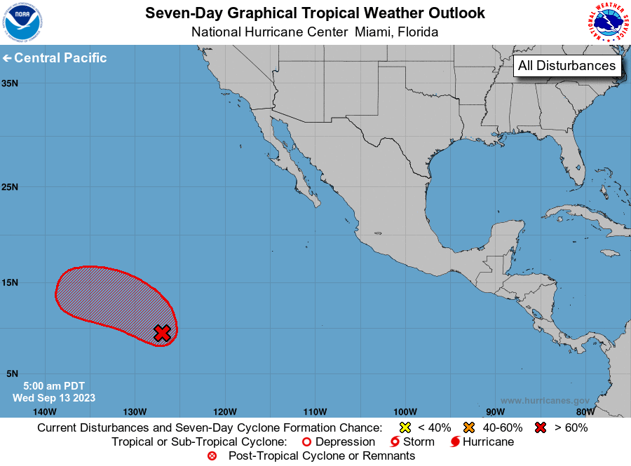
1. Western East Pacific (EP94):
A broad area of low pressure located well to the southwest of the
southern tip of the Baja California Peninsula is producing a large
area of disorganized showers and thunderstorms. Environmental
conditions appear conducive for development of this system, and a
tropical depression is likely to form during the next two or three
days while it moves west-northwestward to northwestward at 10 to 15
mph. By the weekend, upper-level winds are forecast to become less
favorable for additional development while the system moves slowly
westward.
* Formation chance through 48 hours...medium...60 percent.
* Formation chance through 7 days...high...70 percent.
Forecaster Cangialosi