ZCZC MIATWOEP ALL
TTAA00 KNHC DDHHMM
Tropical Weather Outlook
NWS National Hurricane Center Miami FL
500 PM PDT Thu Sep 14 2023
For the eastern North Pacific...east of 140 degrees west longitude:
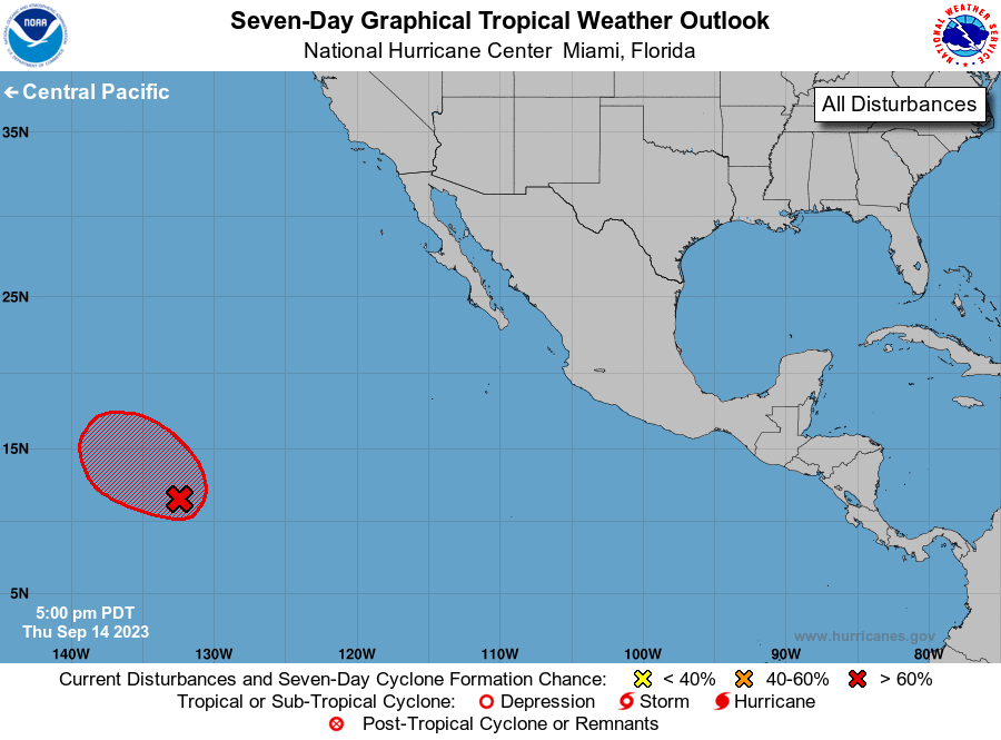
1. Western East Pacific (EP94):
Showers and thunderstorms associated with a broad area of low
pressure located well to the west-southwest of the southern tip of
the Baja California peninsula are becoming better organized.
Environmental conditions appear conducive for further development of
this system, and a tropical depression is likely to form during the
next day or so while it moves west-northwestward to northwestward at
10 to 15 mph over the western portion of the eastern Pacific basin.
* Formation chance through 48 hours...high...90 percent.
* Formation chance through 7 days...high...90 percent.
Forecaster Kelly