ZCZC MIATWOEP ALL
TTAA00 KNHC DDHHMM
Tropical Weather Outlook
NWS National Hurricane Center Miami FL
500 AM PDT Sat Sep 16 2023
For the eastern North Pacific...east of 140 degrees west longitude:
Active Systems:
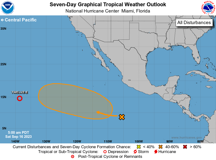
The National Hurricane Center is issuing advisories on Tropical
Depression Twelve-E, located over the western portion of the East
Pacific.
1. Central East Pacific:
A broad area of low pressure located well south of the coast of
southwestern Mexico is producing disorganized showers and
thunderstorms. Environmental conditions are forecast to become
conducive for gradual development of this system by early next
week while the system moves west-northwestward over the central
and western portions of the east Pacific.
* Formation chance through 48 hours...low...near 0 percent.
* Formation chance through 7 days...medium...40 percent.
Public Advisories on Tropical Depression Twelve-E are issued under
WMO header WTPZ32 KNHC and under AWIPS header MIATCPEP2.
Forecast/Advisories on Tropical Depression Twelve-E are issued
under WMO header WTPZ22 KNHC and under AWIPS header MIATCMEP2.
Forecaster Cangialosi