ZCZC MIATWOEP ALL
TTAA00 KNHC DDHHMM
Tropical Weather Outlook
NWS National Hurricane Center Miami FL
1100 PM PDT Sat Sep 16 2023
For the eastern North Pacific...east of 140 degrees west longitude:
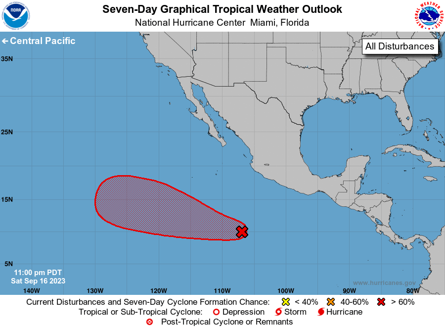
1. Central East Pacific:
A broad area of low pressure located well south-southwest of the
coast of southern Mexico is producing disorganized showers and
thunderstorms. This system has become better organized since
yesterday, and environmental conditions are forecast to become more
conducive for further development. A tropical depression is likely
to form around the middle of next week while the system moves west-
northwestward over the central and western portions of the basin.
* Formation chance through 48 hours...low...20 percent.
* Formation chance through 7 days...high...70 percent.
Forecaster Blake