ZCZC MIATWOEP ALL
TTAA00 KNHC DDHHMM
Tropical Weather Outlook
NWS National Hurricane Center Miami FL
500 AM PDT Mon Sep 18 2023
For the eastern North Pacific...east of 140 degrees west longitude:
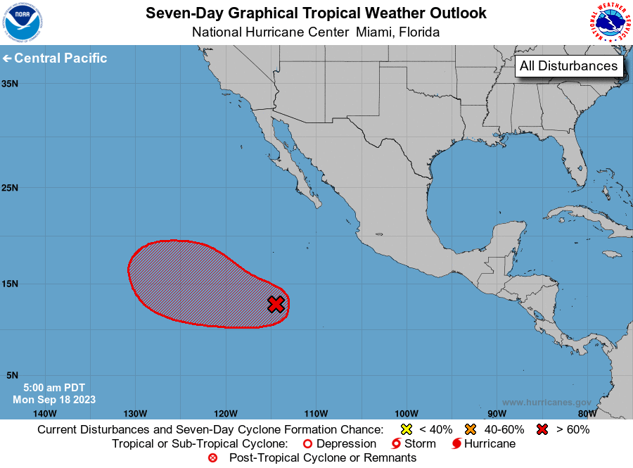
1. Central East Pacific (EP95):
A broad area of low pressure located well south-southwest of the
southern tip of the Baja California peninsula continues to produce
disorganized shower and thunderstorm activity. Environmental
conditions are expected to be conducive for gradual development
during the next few days, and a tropical depression is likely to
form by the middle or latter part of this week while the system
moves generally west-northwestward over the central and western
portions of the basin.
* Formation chance through 48 hours...medium...60 percent.
* Formation chance through 7 days...high...90 percent.
Forecaster B. Reinhart/A. Reinhart