ZCZC MIATWOEP ALL
TTAA00 KNHC DDHHMM
Tropical Weather Outlook
NWS National Hurricane Center Miami FL
500 PM PDT Mon Sep 18 2023
For the eastern North Pacific...east of 140 degrees west longitude:
1. Central East Pacific (EP95):
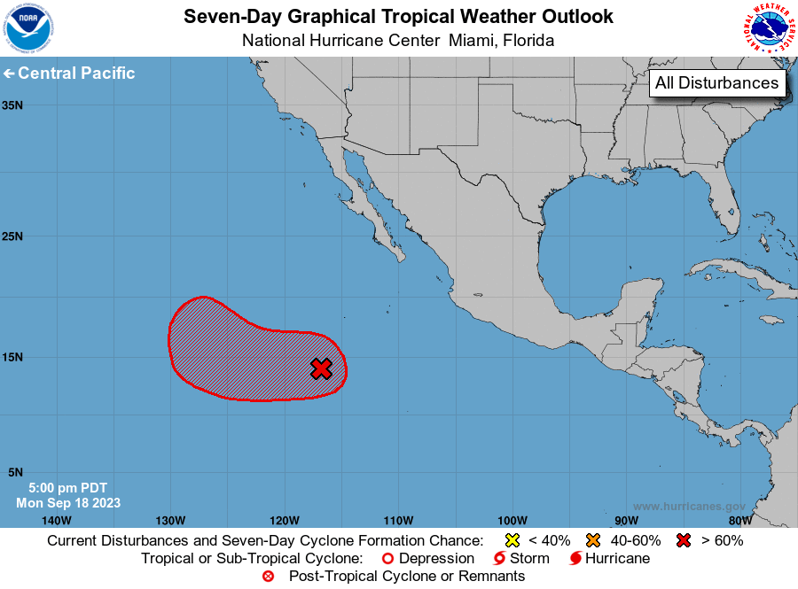
A low pressure system located well southwest of the southern tip of
the Baja California peninsula has become better defined today. The
associated shower and thunderstorm activity has decreased slightly
during the past several hours but is also showing signs of becoming
more organized. Further development is expected and a tropical
depression is likely to form during the next day or so. This system
is forecast to move slowly west-northwestward for the next 24 hours,
and then turn northward by late Wednesday over the western portion
of the basin.
* Formation chance through 48 hours...high...80 percent.
* Formation chance through 7 days...high...90 percent.
Forecaster D. Zelinsky