ZCZC MIATWOEP ALL
TTAA00 KNHC DDHHMM
Tropical Weather Outlook
NWS National Hurricane Center Miami FL
1100 PM PDT Mon Sep 18 2023
For the eastern North Pacific...east of 140 degrees west longitude:
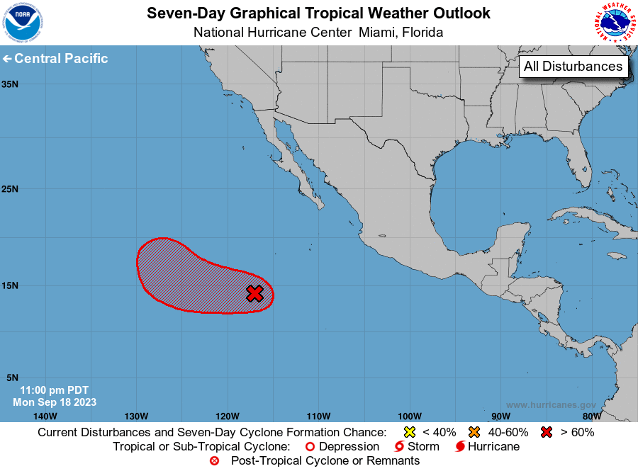
1. Central East Pacific (EP95):
Showers and thunderstorms have increased near an area of low
pressure located several hundred miles southwest of the southern
tip of the Baja California peninsula. Environmental conditions
appear to be conducive for further development, and this low is
expected to become a tropical depression on Tuesday. This system is
forecast to move slowly west-northwestward for the next day or so
and then turn northward by late Wednesday over the western portion
of the basin.
* Formation chance through 48 hours...high...90 percent.
* Formation chance through 7 days...high...90 percent.
Forecaster Blake