ZCZC MIATWOEP ALL
TTAA00 KNHC DDHHMM
Tropical Weather Outlook
NWS National Hurricane Center Miami FL
500 AM PDT Wed Sep 20 2023
For the eastern North Pacific...east of 140 degrees west longitude:
Active Systems:
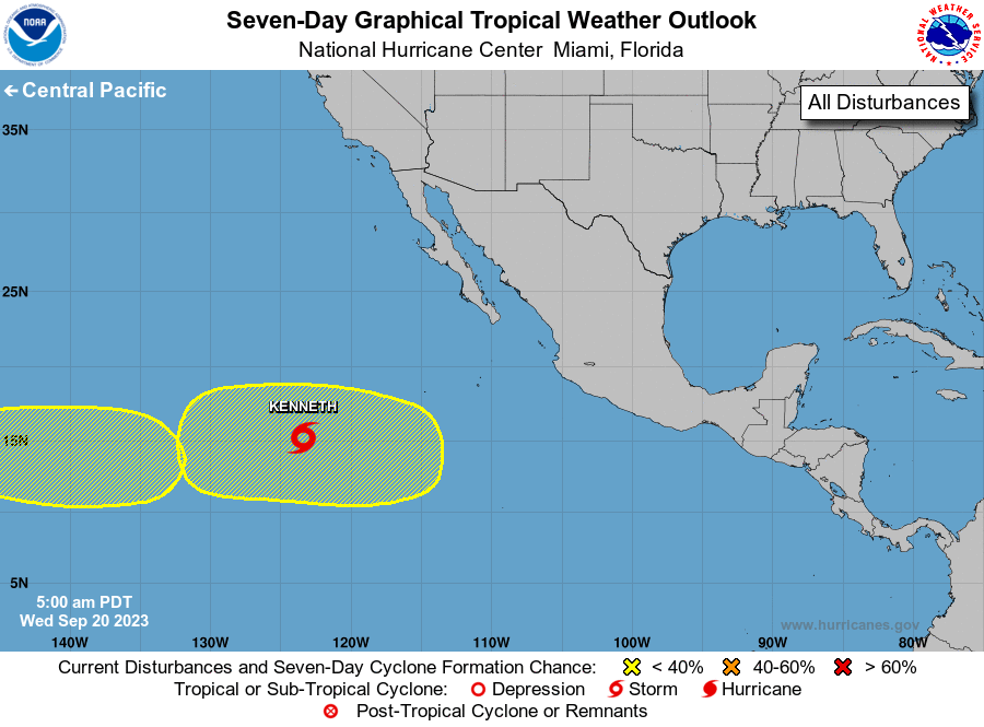
The National Hurricane Center is issuing advisories on Tropical
Storm Kenneth, located about 1000 miles west-southwest of the
southern tip of the Baja California peninsula.
1. Central East Pacific:
An area of low pressure is expected to form in a few days well
southwest of the southern tip of the Baja California peninsula.
Some slow development of this system is possible this weekend and
early next week while it moves westward to west-northwestward.
* Formation chance through 48 hours...low...near 0 percent.
* Formation chance through 7 days...low...30 percent.
2. Western East Pacific:
Another area of low pressure is expected to form in a few days well
southeast of the Hawaiian Islands. Some gradual development
of this system is possible late this weekend and early next week
while it moves generally westward into the Central Pacific basin.
* Formation chance through 48 hours...low...near 0 percent.
* Formation chance through 7 days...low...20 percent.
Forecaster Roberts