ZCZC MIATWOEP ALL
TTAA00 KNHC DDHHMM
Tropical Weather Outlook
NWS National Hurricane Center Miami FL
1100 AM PDT Thu Sep 21 2023
For the eastern North Pacific...east of 140 degrees west longitude:
Active Systems:
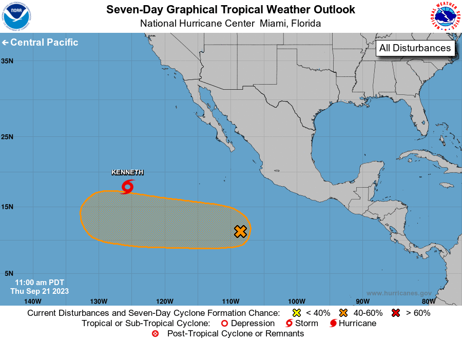
The National Hurricane Center is issuing advisories on Tropical
Storm Kenneth, located about 1100 miles west-southwest
of the southern tip of the Baja California peninsula.
1. Central East Pacific:
A low pressure trough located several hundred miles south-southwest
of the southwestern coast of Mexico is producing a broad area of
showers and thunderstorms. Gradual development of this system is
possible over the next several days, and a tropical depression could
form by late this weekend or early next week while it moves
generally westward across the central and western part of the
eastern Pacific basin.
* Formation chance through 48 hours...low...20 percent.
* Formation chance through 7 days...medium...50 percent.
Forecaster Pasch