ZCZC MIATWOEP ALL
TTAA00 KNHC DDHHMM
Tropical Weather Outlook
NWS National Hurricane Center Miami FL
500 PM PDT Fri Sep 22 2023
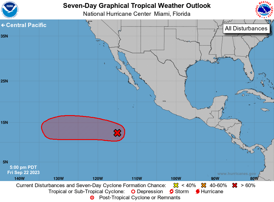
For the eastern North Pacific...east of 140 degrees west longitude:
1. Central East Pacific (EP97):
Showers and thunderstorms associated with a tropical wave located
several hundred miles south-southwest of the southern tip of the
Baja California peninsula continue to show signs of organization.
Further development of the disturbance is likely, and a tropical
depression is expected to form this weekend or early next week while
the system moves generally westward across the central and western
parts of the eastern Pacific basin.
* Formation chance through 48 hours...medium...60 percent.
* Formation chance through 7 days...high...80 percent.
Forecaster Bucci