ZCZC MIATWOEP ALL
TTAA00 KNHC DDHHMM
Tropical Weather Outlook
NWS National Hurricane Center Miami FL
500 PM PDT Thu Sep 28 2023
For the eastern North Pacific...east of 140 degrees west longitude:
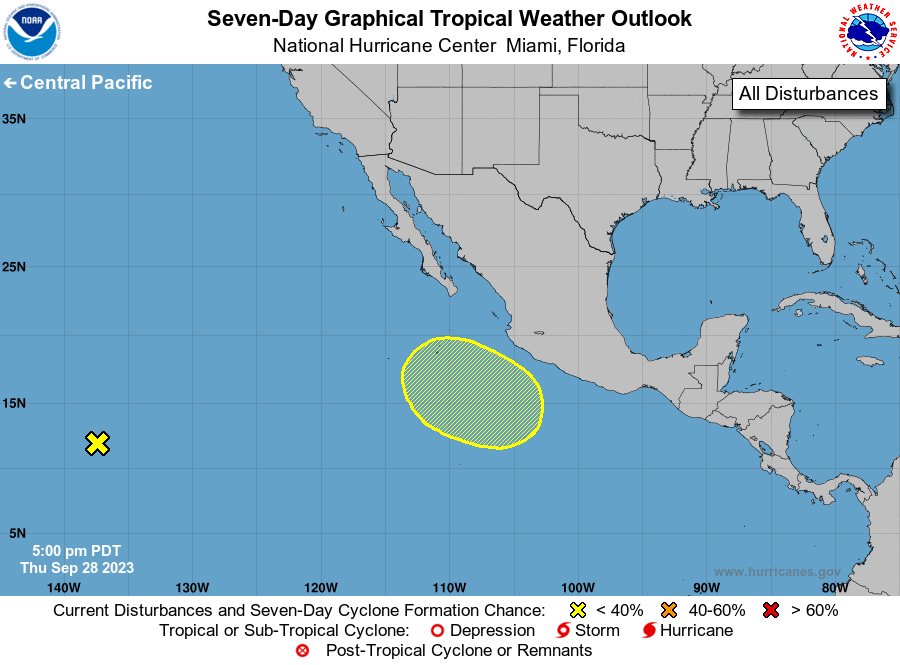
1. Southwestern East Pacific:
A tropical wave located well east-southeast of the Hawaiian Islands
continues to produce disorganized showers and thunderstorms.
Development of this system is not expected due to unfavorable
environmental conditions. The wave is forecast to continue moving
westward across the central Pacific during the next few days.
* Formation chance through 48 hours...low...near 0 percent.
* Formation chance through 7 days...low...near 0 percent.
2. South of Mexico:
An area of low pressure is expected to form south of Mexico early
next week. Slow development of the system will be possible while it
moves generally northwestward off the southwest coast of Mexico
during the middle to late portions of next week.
* Formation chance through 48 hours...low...near 0 percent.
* Formation chance through 7 days...low...20 percent.
Forecaster D. Zelinsky