ZCZC MIATWOEP ALL
TTAA00 KNHC DDHHMM
Tropical Weather Outlook
NWS National Hurricane Center Miami FL
500 AM PDT Fri Oct 6 2023
For the eastern North Pacific...east of 140 degrees west longitude:
Active Systems:
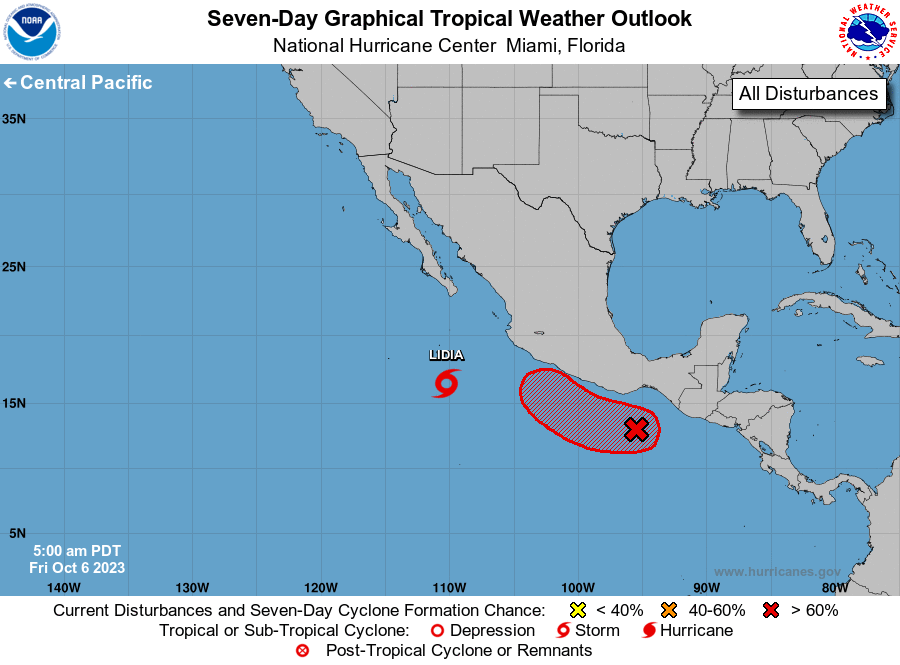
The National Hurricane Center is issuing advisories on Tropical
Storm Lidia, located several hundred miles south of the southern
tip of the Baja California peninsula.
1. South of Southern Mexico (EP99):
An area of low pressure is centered about 200 miles south of the
Gulf of Tehuantepec. Shower and thunderstorm activity associated
with the low is currently limited and disorganized. However,
environmental conditions are expected to be conducive for gradual
development during the next several days, and a tropical depression
is likely to form late this weekend or early next week. The
disturbance is forecast to move slowly west-northwestward for the
next two days, and then turn northward and move closer to the
southern coast of Mexico on Sunday.
* Formation chance through 48 hours...medium...50 percent.
* Formation chance through 7 days...high...80 percent.
Forecaster D. Zelinsky