ZCZC MIATWOEP ALL
TTAA00 KNHC DDHHMM
Tropical Weather Outlook
NWS National Hurricane Center Miami FL
1100 PM PDT Sat Oct 7 2023
For the eastern North Pacific...east of 140 degrees west longitude:
Active Systems:
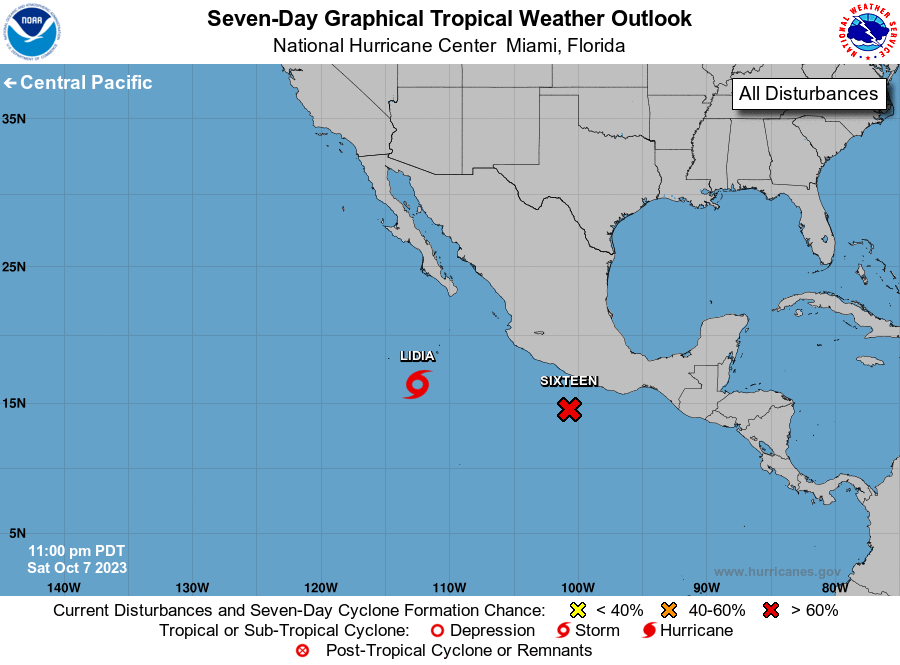
The National Hurricane Center is issuing advisories on Tropical
Storm Lidia, located several hundred miles south-southwest of the
southern tip of the Baja California peninsula.
The National Hurricane Center is issuing advisories on Potential
Tropical Cyclone Sixteen, located a little over 200 miles
south-southeast of the southern coast of Mexico.
* Formation chance through 48 hours...high...90 percent.
* Formation chance through 5 days...high...90 percent.
&&
Public Advisories on Potential Tropical Cyclone Sixteen are issued
under WMO header WTPZ31 KNHC and under AWIPS header MIATCPEP1.
Forecast/Advisories on Potential Tropical Cyclone Sixteen are
issued under WMO header WTPZ21 KNHC and under AWIPS header
MIATCMEP1.
$$
Forecaster Roberts
NNNN