ZCZC MIATWOEP ALL
TTAA00 KNHC DDHHMM
Tropical Weather Outlook
NWS National Hurricane Center Miami FL
500 PM PDT Sat Oct 14 2023
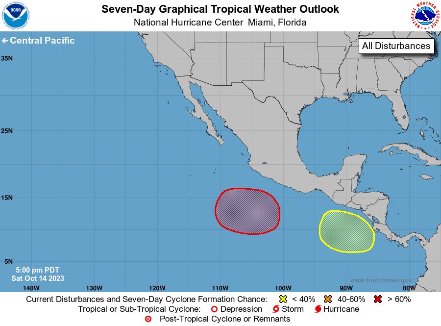
For the eastern North Pacific...east of 140 degrees west longitude:
1. South of Southwestern Mexico:
An area of low pressure is expected to form several hundred miles
south of the southwestern coast of Mexico in a few days. Subsequent
development of the system is likely, and a tropical depression is
expected to form during the middle to latter part of next week while
the system meanders well offshore of the coast of Mexico.
* Formation chance through 48 hours...low...near 0 percent.
* Formation chance through 7 days...high...80 percent.
2. South of Guatemala and El Salvador:
An area of low pressure is expected to form south of the coasts of
Guatemala and El Salvador by the middle of next week. Gradual
development of the disturbance will be possible after that while the
system meanders over the far eastern portion of the eastern North
Pacific basin.
* Formation chance through 48 hours...low...near 0 percent.
* Formation chance through 7 days...low...20 percent.
Forecaster D. Zelinsky