ZCZC MIATWOEP ALL
TTAA00 KNHC DDHHMM
Tropical Weather Outlook
NWS National Hurricane Center Miami FL
500 PM PDT Sun Oct 15 2023
For the eastern North Pacific...east of 140 degrees west longitude:
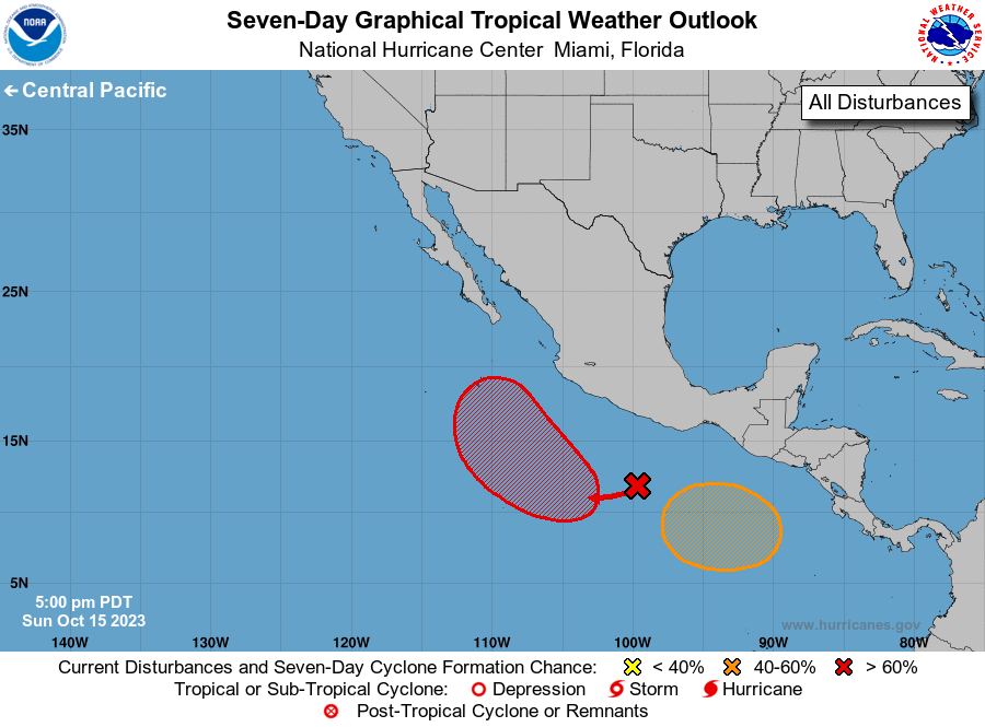
1. South of Southwestern Mexico:
A broad area of low pressure is producing disorganized shower and
thunderstorm activity extending several hundred miles south of the
southern coast of Mexico. Environmental conditions are conducive
for development of this system, and a tropical depression is
expected to form in a few days while moving slowly westward and then
northwestward well offshore of the coast of southwestern Mexico.
* Formation chance through 48 hours...medium...60 percent.
* Formation chance through 7 days...high...90 percent.
2. South of Guatemala and Southern Mexico:
An area of low pressure is expected to form south of the coasts of
Guatemala and southern Mexico by the middle of the week. Gradual
development of the disturbance will be possible, and a tropical
depression could form late this week as the system meanders over
the far eastern portion of the basin.
* Formation chance through 48 hours...low...near 0 percent.
* Formation chance through 7 days...medium...40 percent.
Forecaster Berg