ZCZC MIATWOEP ALL
TTAA00 KNHC DDHHMM
Tropical Weather Outlook
NWS National Hurricane Center Miami FL
500 PM PDT Wed Oct 18 2023
For the eastern North Pacific...east of 140 degrees west longitude:
Active Systems:
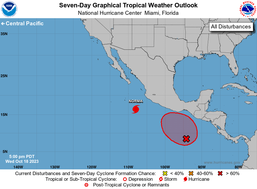
The National Hurricane Center is issuing advisories on strengthening
Hurricane Norma, located several hundred miles south-southeast of
Cabo San Lucas, Mexico.
1. South of Southern Mexico (EP91):
A weak area of low pressure located several hundred miles south of
the Gulf of Tehuantepec is producing a few disorganized showers and
thunderstorms. Any development of this system during the next couple
of days is expected to be slow to occur. However, environmental
conditions are expected to become more favorable for development
thereafter, and a tropical depression is likely to form over the
weekend or early next week. The disturbance is forecast to meander
for the next several days and then drift northward or northwestward
starting on Sunday or Monday.
* Formation chance through 48 hours...low...20 percent.
* Formation chance through 7 days...high...80 percent.
Forecaster D. Zelinsky