ZCZC MIATWOEP ALL
TTAA00 KNHC DDHHMM
Tropical Weather Outlook
NWS National Hurricane Center Miami FL
1100 PM PDT Thu Oct 19 2023
For the eastern North Pacific...east of 140 degrees west longitude:
Active Systems:
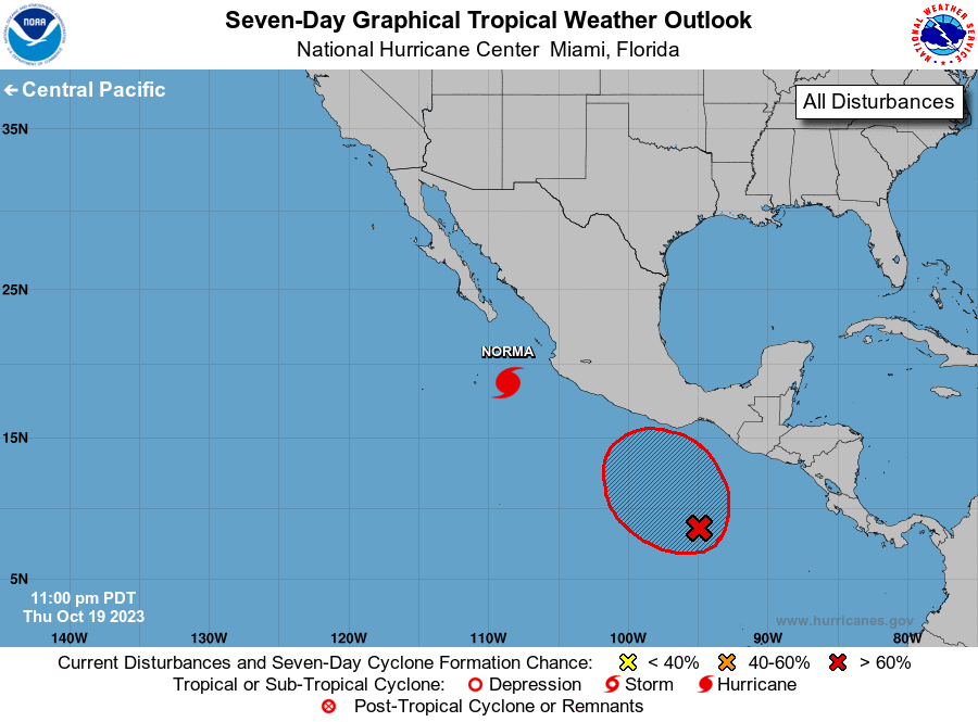
The National Hurricane Center is issuing advisories on Hurricane
Norma, located a little over 300 hundred miles south-southeast of
Cabo San Lucas, Mexico.
1. South of Southern Mexico (EP91):
A broad area of low pressure located several hundred miles south of
the Gulf of Tehuantepec continues to produce a large area of
disorganized showers and thunderstorms. Gradual development of
this system is expected, and a tropical depression will likely
form during the next few days. The system is forecast to meander
during the next couple of days and then move slowly, generally
northward, late this weekend or early next week.
* Formation chance through 48 hours...medium...50 percent.
* Formation chance through 7 days...high...80 percent.
Forecaster Roberts