ZCZC MIATWOEP ALL
TTAA00 KNHC DDHHMM
Tropical Weather Outlook
NWS National Hurricane Center Miami FL
1100 AM PDT Sat Oct 21 2023
For the eastern North Pacific...east of 140 degrees west longitude:
Active Systems:
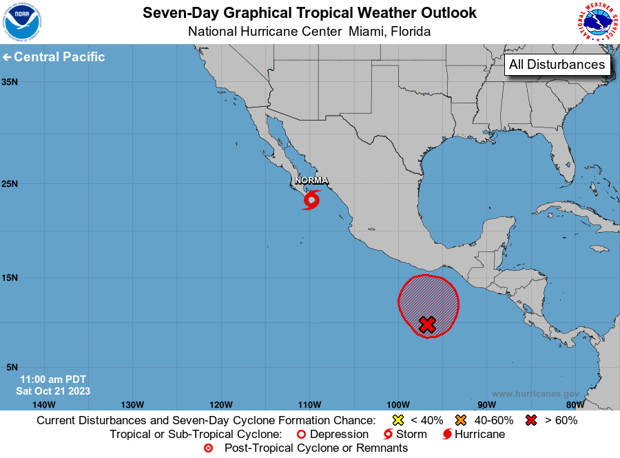
The National Hurricane Center is issuing advisories on Hurricane
Norma, located near the southern tip of the Baja California
peninsula just west of Cabo San Lucas.
1. South of Southern Mexico (EP91):
A broad area of low pressure located several hundred miles south of
the Gulf of Tehuantepec continues to produce a large area of shower
and thunderstorm activity. The upper-level winds are expected to
become more conducive for development of this system during the next
couple of days, and a tropical depression is likely to form by early
next week. The system is forecast to meander or drift generally
northward through early next week.
* Formation chance through 48 hours...high...70 percent.
* Formation chance through 7 days...high...80 percent.
Forecaster Reinhart