ZCZC MIATWOEP ALL
TTAA00 KNHC DDHHMM
Tropical Weather Outlook
NWS National Hurricane Center Miami FL
1100 PM PDT Sat Oct 21 2023
For the eastern North Pacific...east of 140 degrees west longitude:
Active Systems:
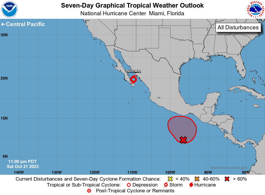
The National Hurricane Center is issuing advisories on recently
downgraded Tropical Storm Norma, located near the southeastern coast
of the Baja California peninsula.
1. South of Southern Mexico (EP91):
Recent satellite wind data indicate that the circulation associated
with a broad area of low pressure located several hundred miles
south of the Gulf of Tehuantepec has become better defined. However,
the associated shower and thunderstorm activity is displaced well to
the northwest and west of the center. The upper-level winds are
expected to become more conducive for development of this system,
and a tropical depression is likely to form during the next couple
of days. The system is forecast to meander or drift generally
northward through early next week.
* Formation chance through 48 hours...high...70 percent.
* Formation chance through 7 days...high...80 percent.
Forecaster Brown