ZCZC MIATWOEP ALL
TTAA00 KNHC DDHHMM
Tropical Weather Outlook
NWS National Hurricane Center Miami FL
500 AM PDT Tue Oct 24 2023
For the eastern North Pacific...east of 140 degrees west longitude:
Active Systems:
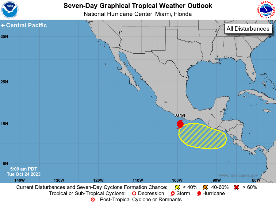
The National Hurricane Center is issuing advisories on Tropical
Storm Otis, located about 175 miles south-southeast of Acapulco,
Mexico.
1. South of Central America and Mexico:
A broad area of low pressure is likely to form in a couple of days
over the far eastern Pacific, partially related to the remnants of
Atlantic Tropical Depression Twenty-One which are forecast to move
into the region. Environmental conditions could support some slow
development of this system by late this week or this weekend while
the low moves slowly westward to west-northwestward.
* Formation chance through 48 hours...low...near 0 percent.
* Formation chance through 5 days...low...20 percent.
Forecaster Pasch