ZCZC MIATWOEP ALL
TTAA00 KNHC DDHHMM
Tropical Weather Outlook
NWS National Hurricane Center Miami FL
500 AM PDT Thu Oct 26 2023
For the eastern North Pacific...east of 140 degrees west longitude:
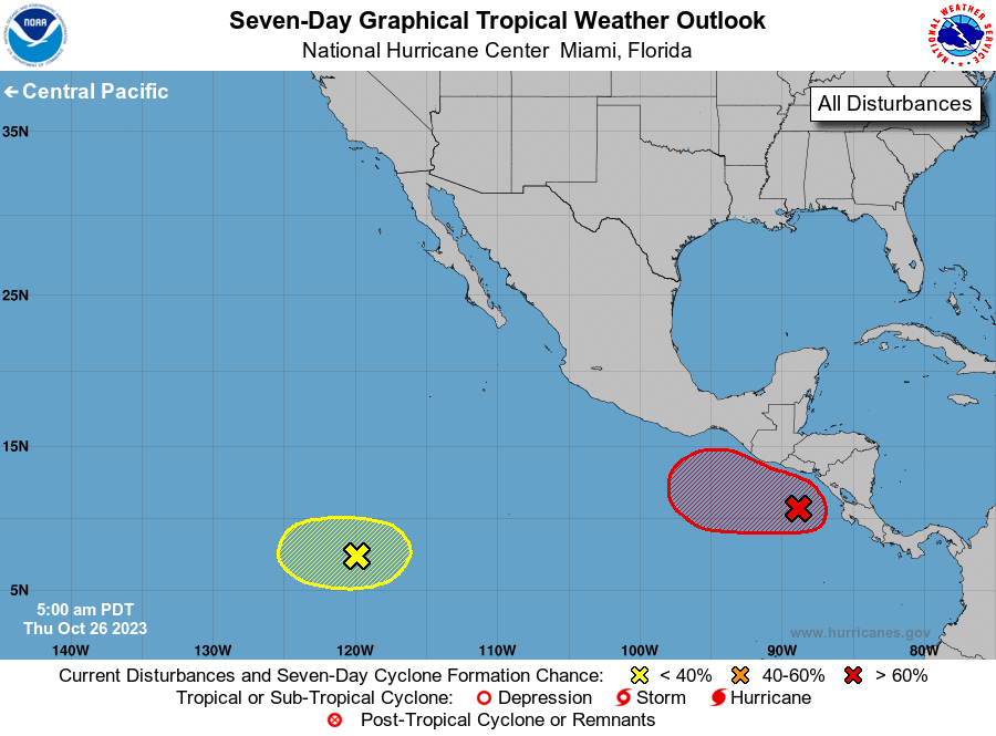
1. South of Central America and Mexico (EP92):
A broad area of low pressure located a little over one hundred miles
south of the southern coast of Central America is producing
disorganized showers and thunderstorms. Environmental conditions
appear to be conducive for development of this system, and a
tropical depression is likely to form by this weekend while the low
moves slowly west-northwestward to northwestward.
* Formation chance through 48 hours...medium...60 percent.
* Formation chance through 7 days...high...80 percent.
2. Southwestern East Pacific:
A weak area of low pressure located about 1200 miles south-southwest
of the southern tip of the Baja California peninsula is producing
limited shower activity. Environmental conditions are marginally
conducive for some slow development of this system during the next
several days while it meanders over the southwestern east Pacific.
* Formation chance through 48 hours...low...near 0 percent.
* Formation chance through 7 days...low...20 percent.
Forecaster Pasch