ZCZC MIATWOEP ALL
TTAA00 KNHC DDHHMM
Tropical Weather Outlook
NWS National Hurricane Center Miami FL
500 AM PDT Mon Oct 30 2023
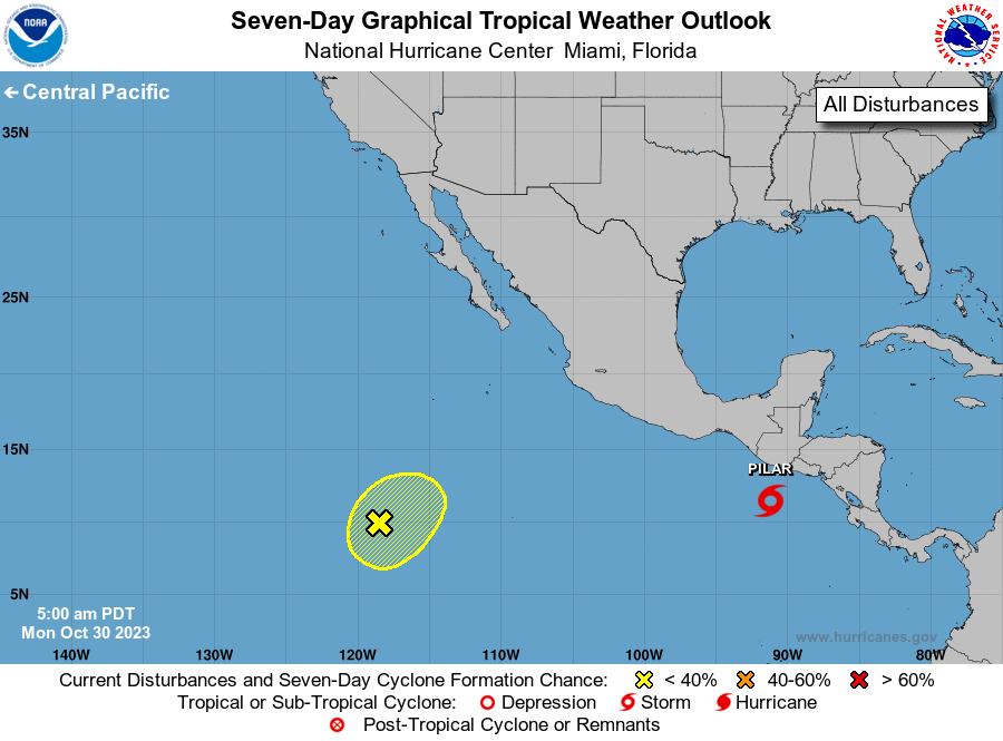
For the eastern North Pacific...east of 140 degrees west longitude:
Active Systems:
The National Hurricane Center is issuing advisories on Tropical
Storm Pilar, located a couple of hundred miles southwest of the
coast of El Salvador.
1. Southwestern East Pacific (EP93):
An area of low pressure located about 1000 miles south-southwest
of the southern tip of the Baja California peninsula is producing
disorganized shower activity. Environmental conditions are
marginally conducive for slow development of this system during
the next couple of days while the low drifts generally
northeastward. By the middle of the week, upper-level winds are
forecast to become less conducive for additional development.
* Formation chance through 48 hours...low...30 percent.
* Formation chance through 7 days...low...30 percent.
Forecaster Bucci