ZCZC MIATWOEP ALL
TTAA00 KNHC DDHHMM
Tropical Weather Outlook
NWS National Hurricane Center Miami FL
500 PM PDT Tue Oct 31 2023
For the eastern North Pacific...east of 140 degrees west longitude:
Active Systems:
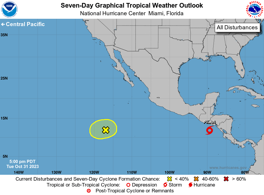
The National Hurricane Center is issuing advisories on Tropical
Storm Pilar, located less than 200 miles south of the coast of El
Salvador.
1. Southwestern East Pacific (EP93):
Disorganized showers and thunderstorms located about 800 miles
south-southwest of the southern tip of the Baja California peninsula
are associated with an elongated area of low pressure. This system
has changed little in organization since earlier today, and
environmental conditions are forecast to become increasingly
unfavorable for development during the next day or two while the
low drifts generally northward.
* Formation chance through 48 hours...low...10 percent.
* Formation chance through 7 days...low...10 percent.
Forecaster Pasch