ZCZC MIATWOEP ALL
TTAA00 KNHC DDHHMM
Tropical Weather Outlook
NWS National Hurricane Center Miami FL
500 AM PDT Wed Nov 1 2023
For the eastern North Pacific...east of 140 degrees west longitude:
Active Systems:
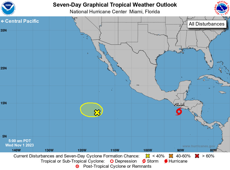
The National Hurricane Center is issuing advisories on Tropical
Storm Pilar, located about 100 miles south of the coast of El
Salvador.
1. Central East Pacific (EP93):
An area of low pressure located several hundred miles south-
southwest of the southern tip of the Baja California peninsula has
become a little better defined since yesterday. However, the
thunderstorm activity remains limited and displaced well to the
north of the circulation center. Environmental conditions are
forecast to become increasingly unfavorable for development during
the next day or two, and significant development of this system
appears unlikely as it meanders over the central portion of the
eastern Pacific basin.
* Formation chance through 48 hours...low...10 percent.
* Formation chance through 7 days...low...10 percent.
Forecaster Brown