ZCZC MIATWOEP ALL
TTAA00 KNHC DDHHMM
Tropical Weather Outlook
NWS National Hurricane Center Miami FL
1100 PM PDT Wed Nov 1 2023
For the eastern North Pacific...east of 140 degrees west longitude:
Active Systems:
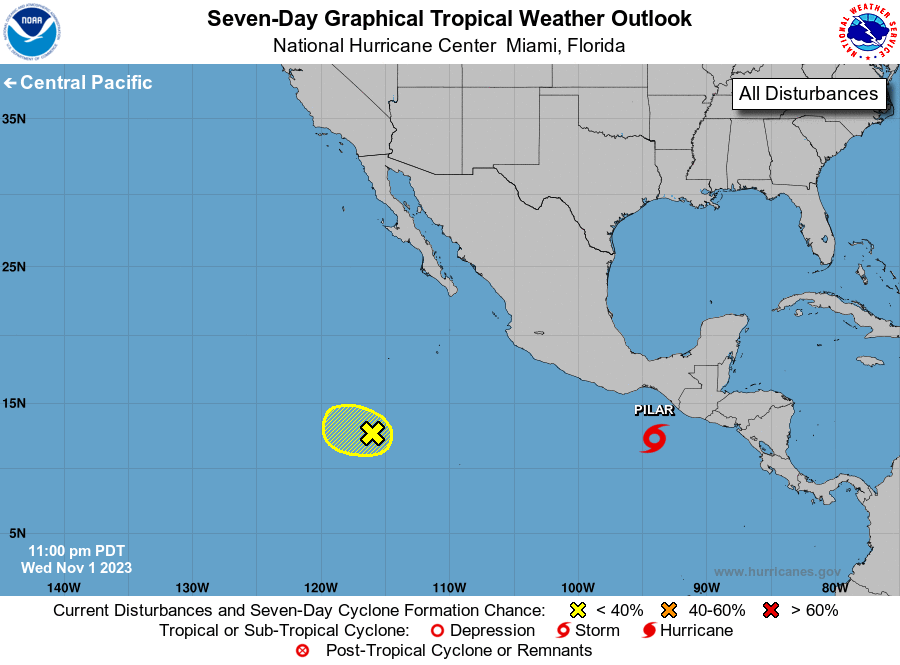
The National Hurricane Center is issuing advisories on Tropical
Storm Pilar, located more than 100 miles southwest of the coast of
Guatemala.
1. Central East Pacific (EP93):
Shower and thunderstorm activity has increased in association with
an area of low pressure located several hundred miles to the
south-southwest of the southern tip of the Baja California
peninsula. Some additional development of this system is possible on
Thursday while it moves slowly northwestward over the central
portion of the eastern Pacific basin. By Friday, upper-level winds
are expected to become increasingly unfavorable for further
development.
* Formation chance through 48 hours...low...20 percent.
* Formation chance through 7 days...low...20 percent.
Forecaster Reinhart