ZCZC MIATWOEP ALL
TTAA00 KNHC DDHHMM
Tropical Weather Outlook
NWS National Hurricane Center Miami FL
1100 PM PDT Thu Nov 2 2023
For the eastern North Pacific...east of 140 degrees west longitude:
Active Systems:
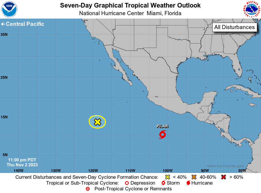
The National Hurricane Center is issuing advisories on Tropical
Storm Pilar, located several hundred miles south of the coast of
southern Mexico.
1. Central East Pacific (EP93):
Shower and thunderstorm activity has diminished in association with
an area of low pressure located several hundred miles southwest of
the southern tip of the Baja California peninsula. Upper-level winds
are expected to strengthen over this system through Friday, and
further development appears unlikely while the low moves westward
over the central portion of the eastern Pacific basin.
* Formation chance through 48 hours...low...10 percent.
* Formation chance through 7 days...low...10 percent.
Forecaster Reinhart