Skip Navigation Links
NOAA NOAA United States Department of Commerce

NHC Graphical Outlook Archive


« Earliest Available         ‹ Earlier         Later ›         Latest Available »
GIS Shapefiles
Central Pacific Eastern Pacific Atlantic

View 2-Day Graphical Tropical Weather Outlook
Click for Atlantic Click for Atlantic

Tropical Weather Outlook Text

ZCZC MIATWOEP ALL
TTAA00 KNHC DDHHMM

Tropical Weather Outlook
NWS National Hurricane Center Miami FL
1000 AM PST Tue Nov 21 2023

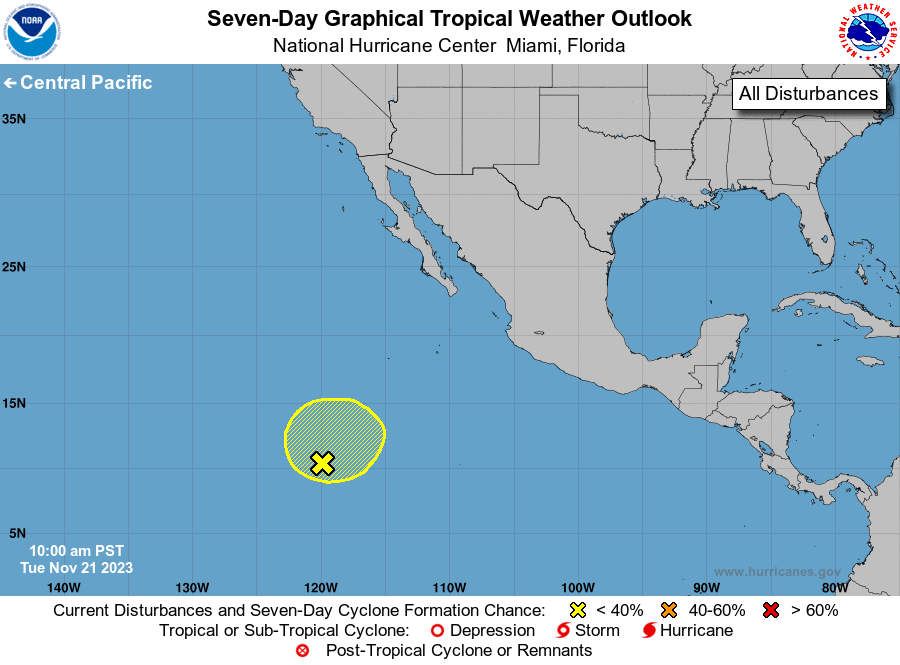
For the eastern North Pacific...east of 140 degrees west longitude:

1. Central East Pacific (EP94):
An elongated area of low pressure located well south-southwest of 
the southern tip of the Baja California peninsula continues to 
produce disorganized showers and thunderstorms.  Development of this 
system, if any, is likely to be slow to occur while it drifts 
generally northward during the next several days.  Environmental 
conditions are forecast to become less conducive for development by 
the latter part of this week.
* Formation chance through 48 hours...low...20 percent.
* Formation chance through 7 days...low...20 percent.

Forecaster Hogsett/Kelly


List of Atlantic Outlooks (May 2023 - Present)
List of East Pacific Outlooks (May 2023 - Present)
List of Central Pacific Outlooks (May 2023 - Present)
List of Atlantic Outlooks (July 2014 - April 2023)
List of East Pacific Outlooks (July 2014 - April 2023)
List of Central Pacific Outlooks (June 2019 - April 2023)
List of Atlantic Outlooks (June 2009 - June 2014)
List of East Pacific Outlooks (June 2009 - June 2014)