ZCZC MIATWOEP ALL
TTAA00 KNHC DDHHMM
Tropical Weather Outlook
NWS National Hurricane Center Miami FL
400 AM PST Thu Nov 23 2023
For the eastern North Pacific...east of 140 degrees west longitude:
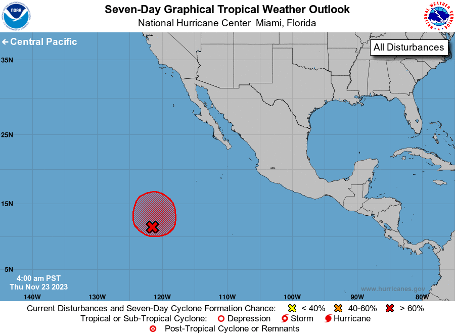
1. Central East Pacific (EP94):
Showers and thunderstorms associated with an area of low pressure
located a little more than 1000 miles southwest of the southern tip
of the Baja California peninsula have persisted and become better
organized this morning. If these development trends continue, a
short-lived tropical depression is likely to form later today while
the system drifts generally northward. Environmental conditions are
forecast to become increasingly unfavorable over the weekend, with
any further development not anticipated.
* Formation chance through 48 hours...high...70 percent.
* Formation chance through 7 days...high...70 percent.
Forecaster Kelly