ZCZC MIATWOAT ALL
TTAA00 KNHC DDHHMM
Tropical Weather Outlook
NWS National Hurricane Center Miami FL
200 AM EDT Wed Aug 24 2022
For the North Atlantic...Caribbean Sea and the Gulf of Mexico:
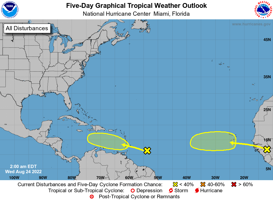
1. East of The Windward Islands:
Shower and thunderstorm activity remains disorganized associated
with a broad trough of low pressure located several hundred miles
east-southeast of the Windward Islands. Environmental conditions
could become more conducive for slow development of this system in
several days while it is forecast to move across the Windward
Islands and into the southeastern Caribbean Sea.
* Formation chance through 48 hours...low...near 0 percent.
* Formation chance through 5 days...low...20 percent.
2. Eastern Tropical Atlantic:
A tropical wave is forecast to move off the west coast of Africa in
a day or two. Environmental conditions could support some slow
development of this system late this week or over the weekend
while it moves westward at 10 to 15 mph.
* Formation chance through 48 hours...low...near 0 percent.
* Formation chance through 5 days...low...20 percent.
Forecaster Papin